
TRIP REPORT: Mt. Whitney in One Day – 8-10-15
Hike Stats at a Glance:
22 miles round trip
~6,400 ft of elevation gain
Sunny and clear skies
~14 hours round trip with many long stops
Summit 14,505 ft, highest in contiguous United States
This is one trip report which is really hard to write simply because trying to remain concise has been very difficult. This day hike is incredible and filled with so many amazing things to look at and enjoy that I could fill a dozen pages with my thoughts and information, not to mention the countless photos. I will try to stick to the basic information since in reality this is not a difficult hike in terms of route finding etc.
The hardest part of climbing Mt. Whitney as I have outlined in another post (HERE), is getting the permit to enter the wilderness area. We showed up the day before the climb at the inter-agency visitor center in Lone Pine and drew a number for the lottery system that day. We drew poorly with a number 15 but luckily we were still able to get a Whitney day use permit for the following day. This was by far the most stressful part of the trip since it would of delayed everything if we had not gotten that permit.
Once we were done with that we decided to get some breakfast before heading up to the Whitney Portal trail head which is about 20 minutes from town and at an elevation of about 7,800 ft. We ate at the Alabama Hills Cafe, which had great breakfast food but was terribly disorganized. I would probably not recommend it if your in a hurry!
Once we gathered all of our things and finished eating we headed out to the campground at the Whitney Portal which would serve as our jumping off point. The drive up to the Whitney Portal out of the desert in Lone Pine is very impressive and enjoyable in its own right. The Sierras are white granite giants shooting out of the red desert, which makes for a very impressive view.

Whitney portal is in the notch as seen from Lone Pine as you drive up from town.
The campground is up at the top of the road right before you reach the hiker parking lots on your left. Some of the sites can be reserved ahead of time but they do save several spots for walk ins on a first come first serve basis. We had no problem finding a spot when we arrived early in the afternoon and found a nice spot next to the brook nestled in the trees. I would say this campground is probably the most beautiful off the road campground I have ever stayed in.
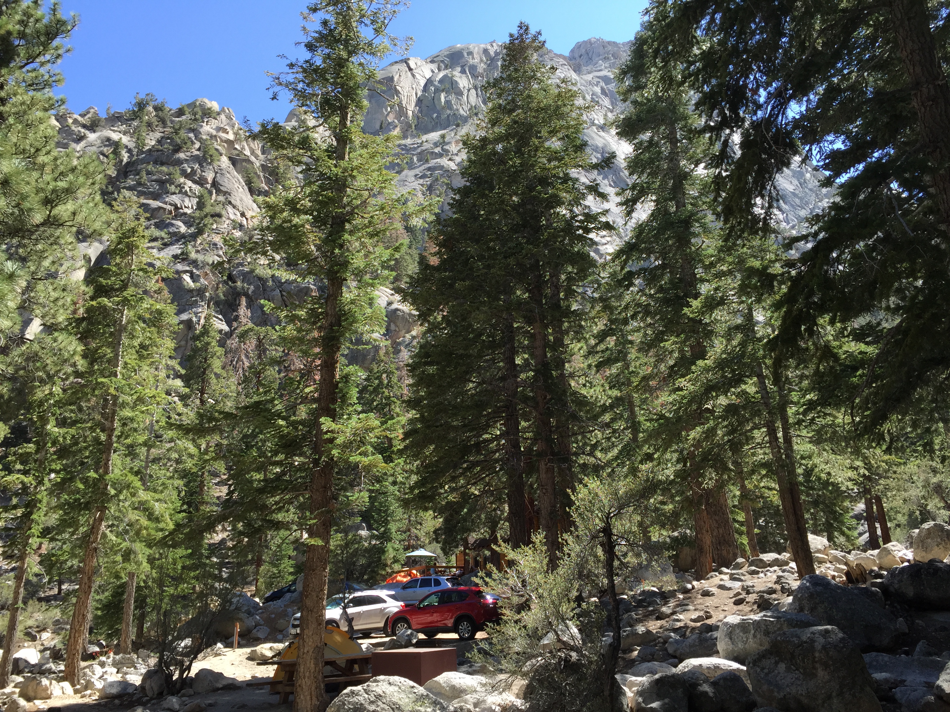
Our campsite at the Whitney Portal
Once we were all settled in it was about 3pm and we intended to start hiking at 3am the following morning, so rest was all that was on the agenda for the rest of the day. Between all the traveling the day before and the jet lag I was fast asleep at 4pm and did not wake up again for 12 hours! Needless to say we got a slightly late start and ended up hitting the trail at about 5am.
Once we were ready to go we drove a short way further up the road and parked at the hiker overflow parking lot. Even at 4am the parking situation was already kind of tough since now in the busy season lots of people cap high up on the mountain to do the hike in 2 days. (Overnight permit required) The trailhead itself is directly across from the restrooms you see on the road just past the overflow lot entrance. We actually walked past the trailhead originally and had to turn back around, a great start!
Originally we had planned to do the Mountaineer’s Route which is steeper and more technical than the regular route but after looking at the map we were not sure that the trail would be easy to follow so we opted to go with the traditional route up. Unfortunately after talking to others on the summit we learned that the trail is actually fairly easy to follow but it does require a steep ascent up loose scree that is not entirely fun or obvious. This is why the Mountaineer’s Route is preferred in the winter when the scree is covered in snow which actually makes it easier to climb.
Since we choose to do the traditional route the name of the game for the day would be switchbacks! More switchbacks than I think any human would think possible. The trail starts with you guessed it, switchbacks, until reaching the top of the Whitney Portal Col.
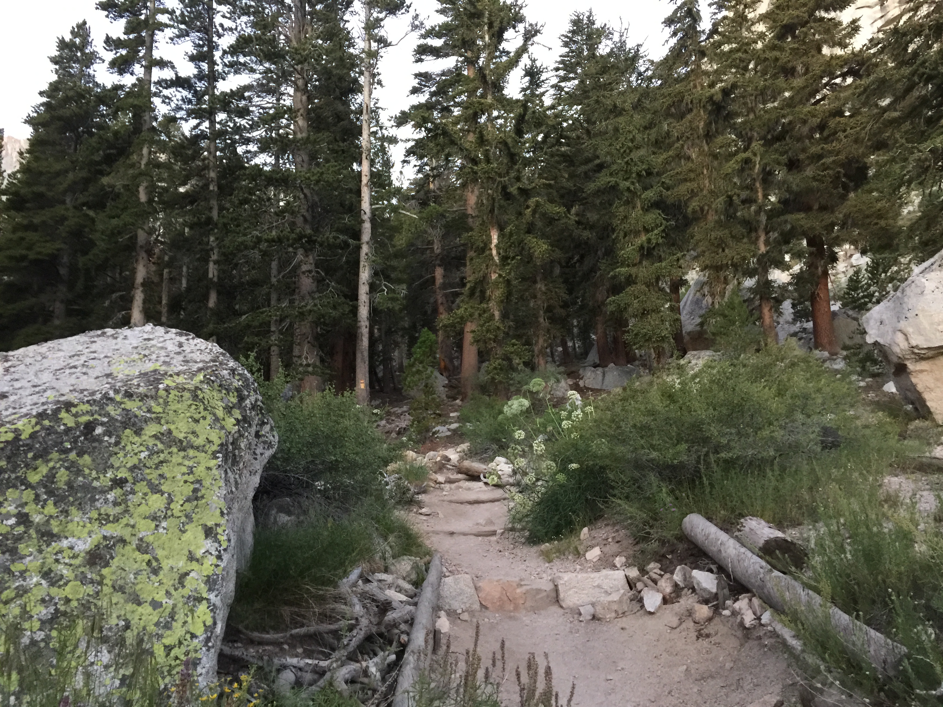
You climb into a pocket of trees at the top of the col after the first set of switchbacks.
The trail is very easy to follow and in great condition. I am used to hiking in the Northeast where there are roots, rocks, and mud on basically every trail so these nice Sierra trails were a good change of pace. There is virtually no mud on this trail and certainly no wet roots to trip over or slip on which is nice, so it is easier to maintain a quicker pace. After a little bit longer of hiking you will begin to get higher above the tree line and get your first unobstructed glimpses of the white granite walls around you. It is a truly magnificent sight. The size and scale of the High Sierras is truly impressive.
Close to this point you will also see a sign pointing to Lone Pine lake off to your left. We actually missed this entirely on the way up but on the way back down we decided to stop. I would highly recommend everyone take the time to stop by this lake as it is a truly beautiful and pristine glacial lake. You also do not need a permit to go up to the lake so it is a great option for a short day hike as well.

Lone Pine Lake
Once the trail flattens out for a bit after the start you will walk across a beautiful vegetated area. This area sits at about 10,000 ft and once you reach the end of it there is the first campground on the trail. It sits in the trees and makes for a nice place to spend the night if you are doing the trip in two days.

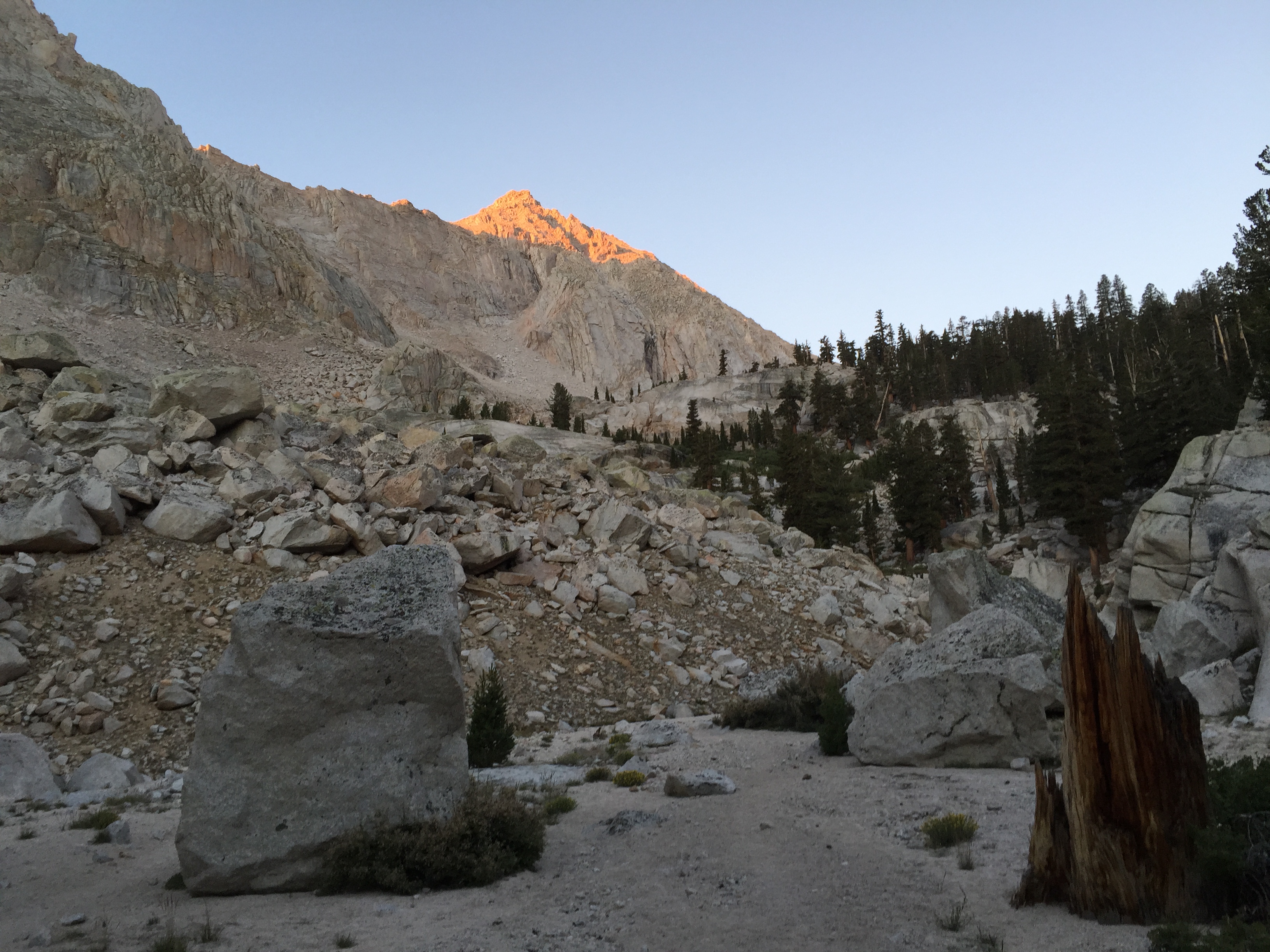
The trail continues past the campground and this is where you finally start working your way above treeline. The trail is kind of steep at times but it is easy to follow and in great shape so it is not technically very demanding. The biggest difficulty with this hike is simply that it is quite long and the altitude can be an issue for people who are not accustomed. Luckily, the altitude never proved to be an issue for myself or my partner so we were still able to keep a nice steady pace upwards.
Working your way up from the first camp towards the Trail Camp (High Camp)
Along the route, shortly before hitting the Trail Camp you will come to another big and beautiful Iceberg Lake which sits at roughly 11,600 ft. It is a great place to stop and take a break and enjoy the views all around you. From here you can also see great views of the Mt Whitney needles and ridge on your right which leads to the summit.
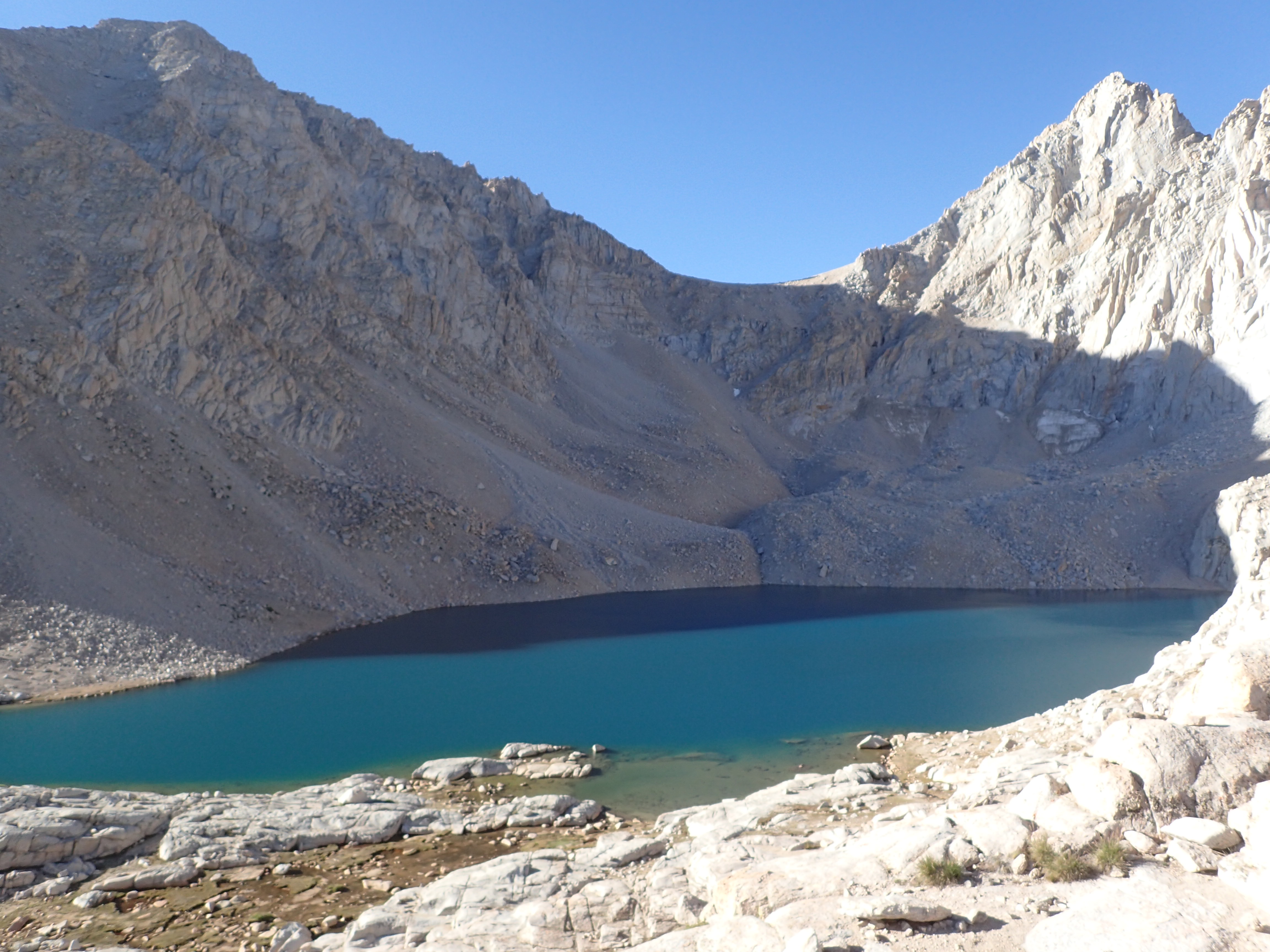
Iceberg Lake
The next major stop along the trail is when you reach the Trail Camp or high camp on the mountain. This camp sits at 12,000 ft and is quite beautiful. This is the most popular campsite on the mountain itself and for good reason. It is mostly flat and also has a nice little pond. On this particular day we had arrived fairly early so most of the people from the night before had packed up and new campers had not yet arrived so it was not outrageously crowded. However, on the way back down later in the day this camping area was quite packed.

Trail Camp
One other fun part about the Trail Camp is that it is full of marmots everywhere. These guys can be a bit of a nuisance as they come by looking for food and will be more than happy to chew threw your backpack to get at it uninvited. (We did see this exact thing happen higher up on the mountain when some hikers left their packs below the summit.) However, I had never seen one before in person and really enjoyed the experience. I thought they were great!
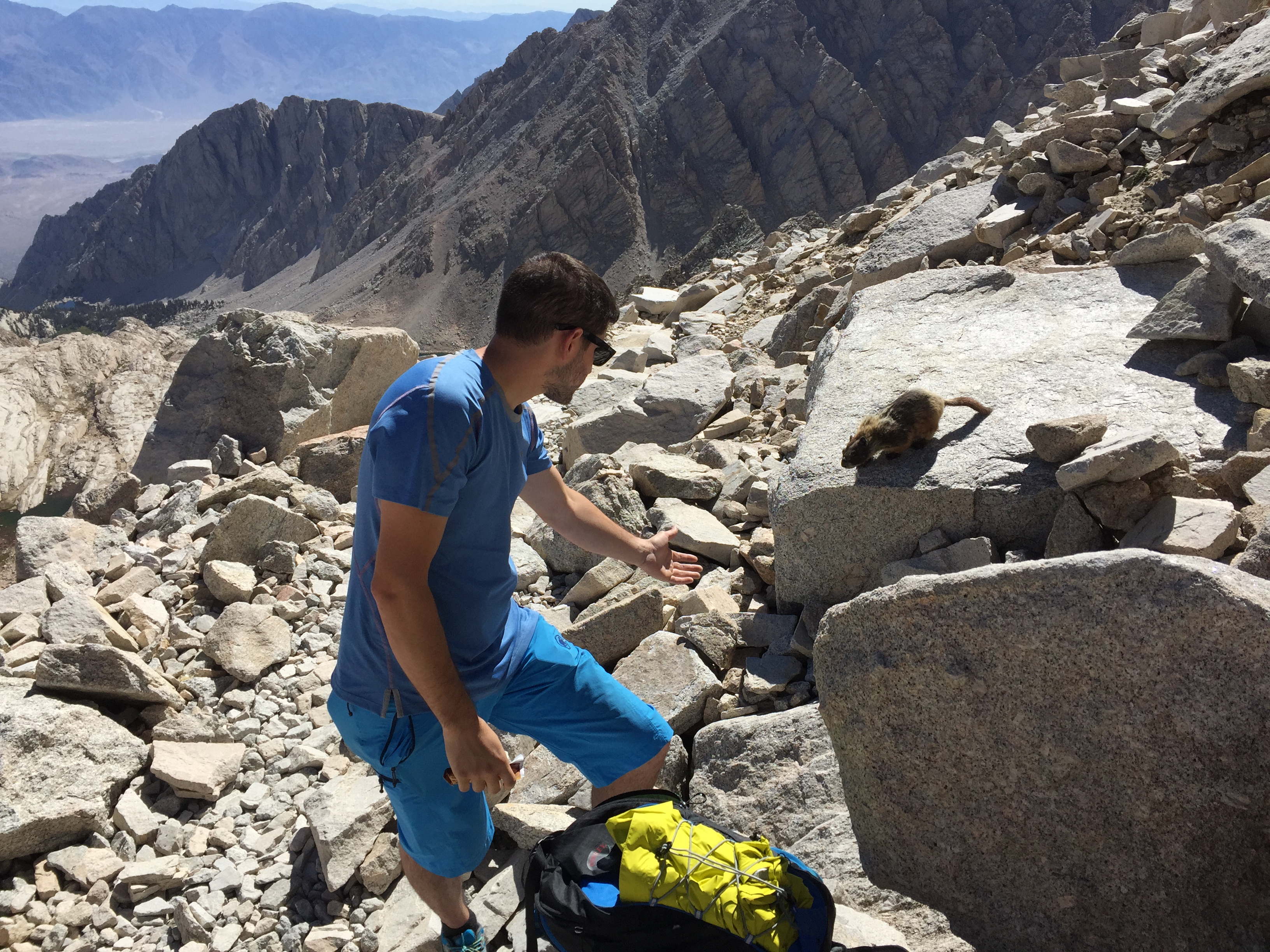
Sorry Mr. Marmot but you cannot have my granola bar.
It is right after the trail camp that you make the biggest elevation gain up the monstrous amount of switchbacks leading up to the ridge above. I believe the official count is that there are 99 switchbacks in total. Honestly it feels more like 1000. They are not particularly hard but they can be a bit mind numbing to climb. I would say that this is the first mental crux of the whole day, with returning back down these switchbacks being the second.

The notch in the middle is what you are aiming for.
Once you finish powering through the endless switchbacks you are greeted by your first views of Sequoia National Park from the top of the ridge where the Trail Crest and John Muir Trail meet. This view is exactly what the doctor ordered to cure your mental fatigue from the 99 switchbacks.

Me enjoying the view at 13,700 ft.
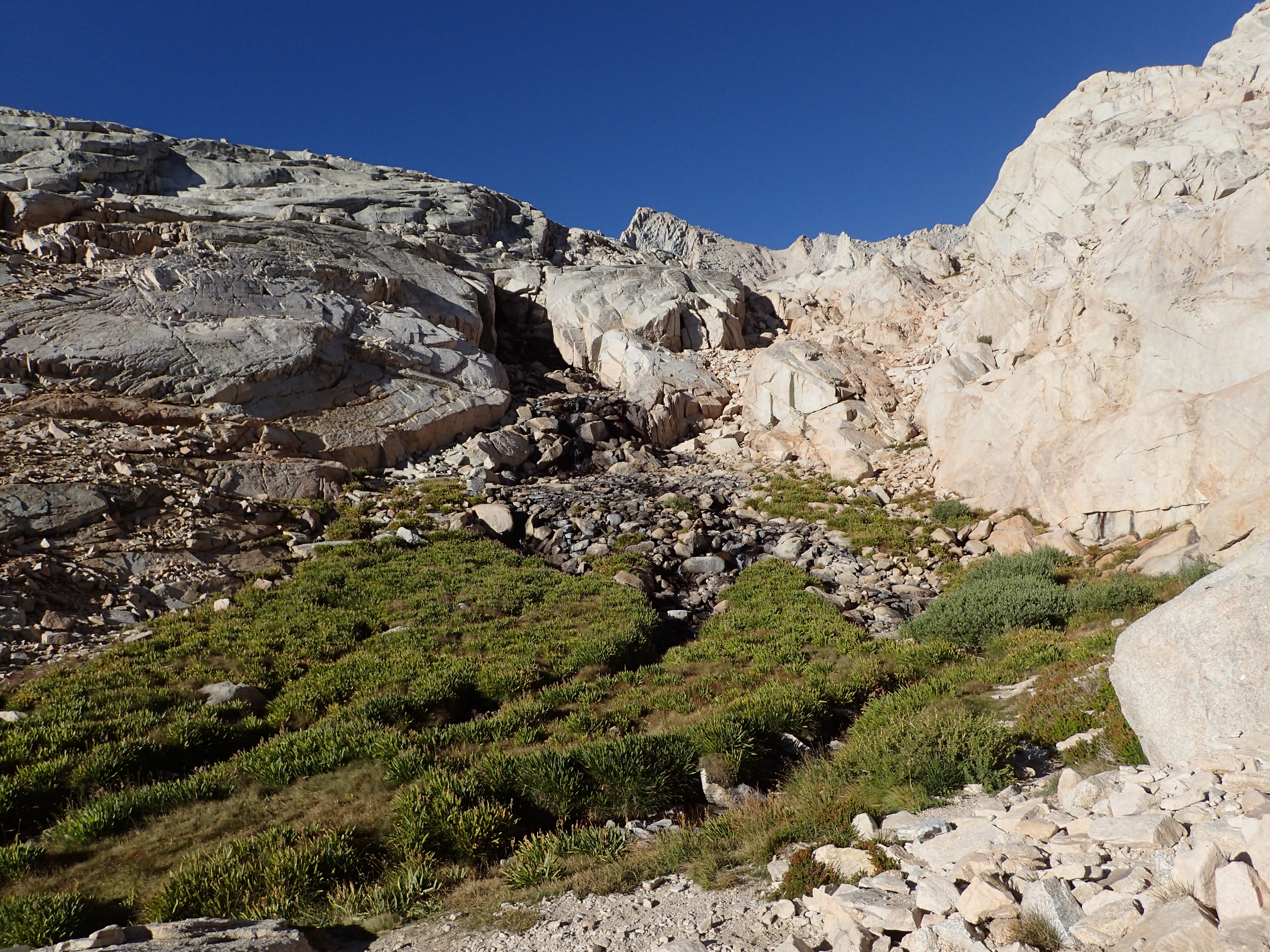
From this point it is only a couple easy miles over fairly flat trail and talus with very minimal elevation gains as the trail junction sits at about 13,700 ft. The trail follows the ridge behind the needles of Mt Whitney whose steep cliffs you could see from the switchbacks. Passing between the needles offers great views along the way and you will also pass the cairns leading up to the summit of Mt Muir. We didn’t take the time to summit Mt Muir, but it is a fairly quick option for those who would like to.
View from between the needles

The final approach from behind the needles.
The summit of Mt Whitney is at the end of the ridge and can be seen in the distance as you approach. You can easily spot the summit of Mt Whitney by the small summit hut that is visible as you get closer. Once you reach the summit you are greeted by the summit hut, which also has a summit register out front. Once we arrived on the summit we signed the register and then went to stand on the summit blocks to enjoy the wonderful views all around us.

Summit Hut
On this particular day the weather was very calm and we had a warm and wind free time on the summit. Since the weather was so nice we stayed for a while to enjoy the views and relax before we headed back down the mountain. We could not have asked for a better time with not even a cloud in sight.
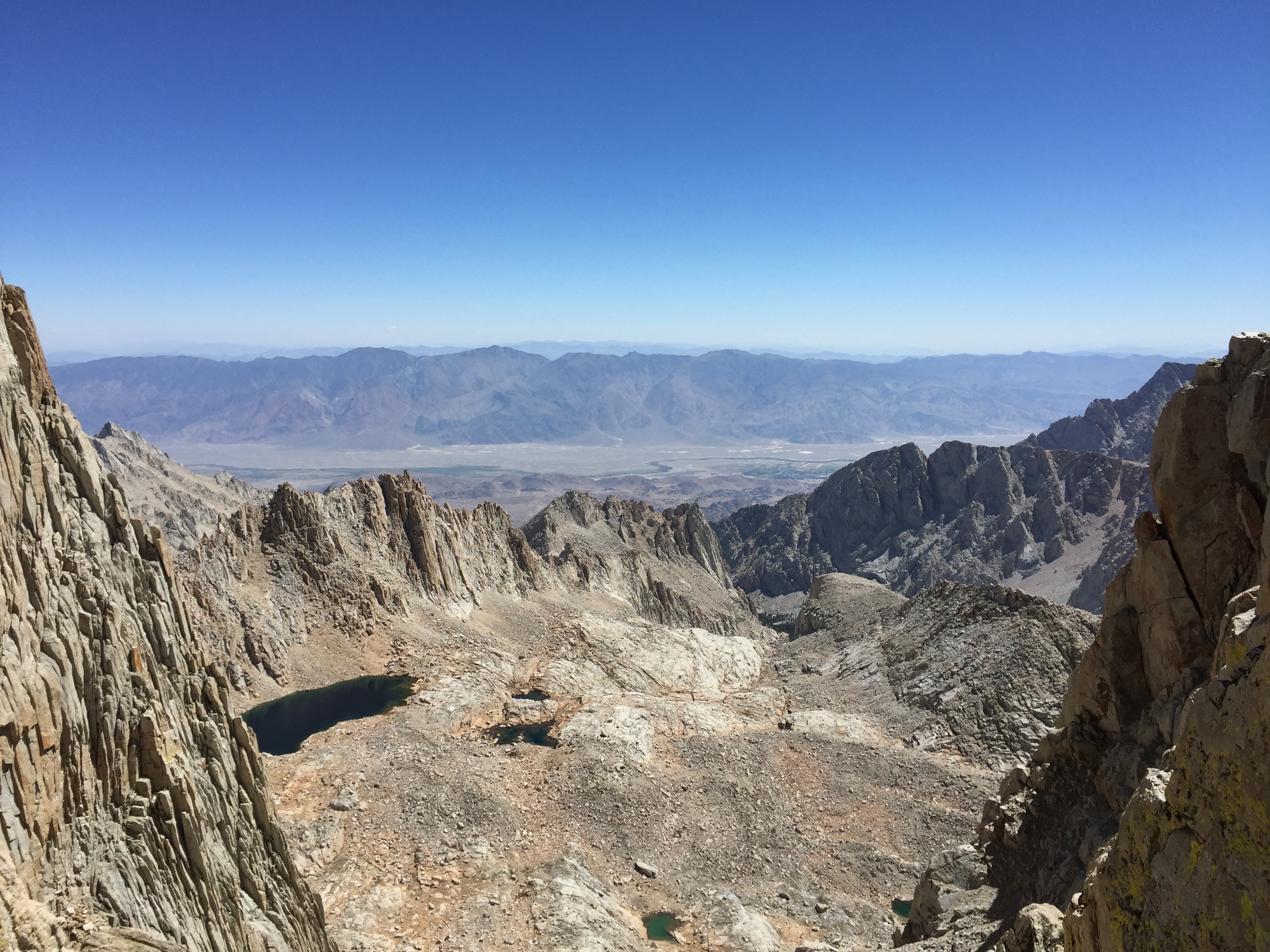
View from the summit looking towards Death Valley in the distance.

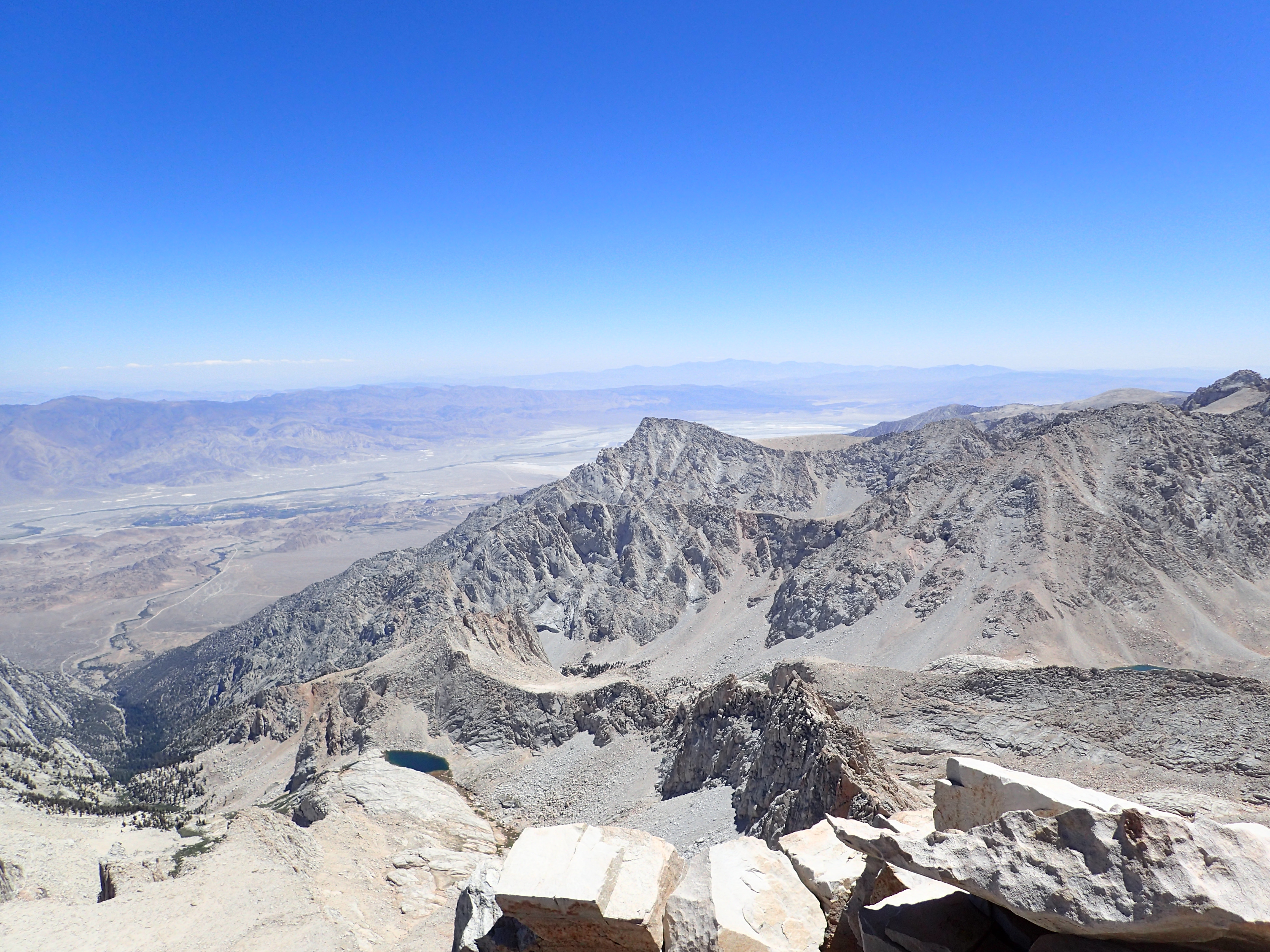
View from the summit towards the rest of the Sierras.
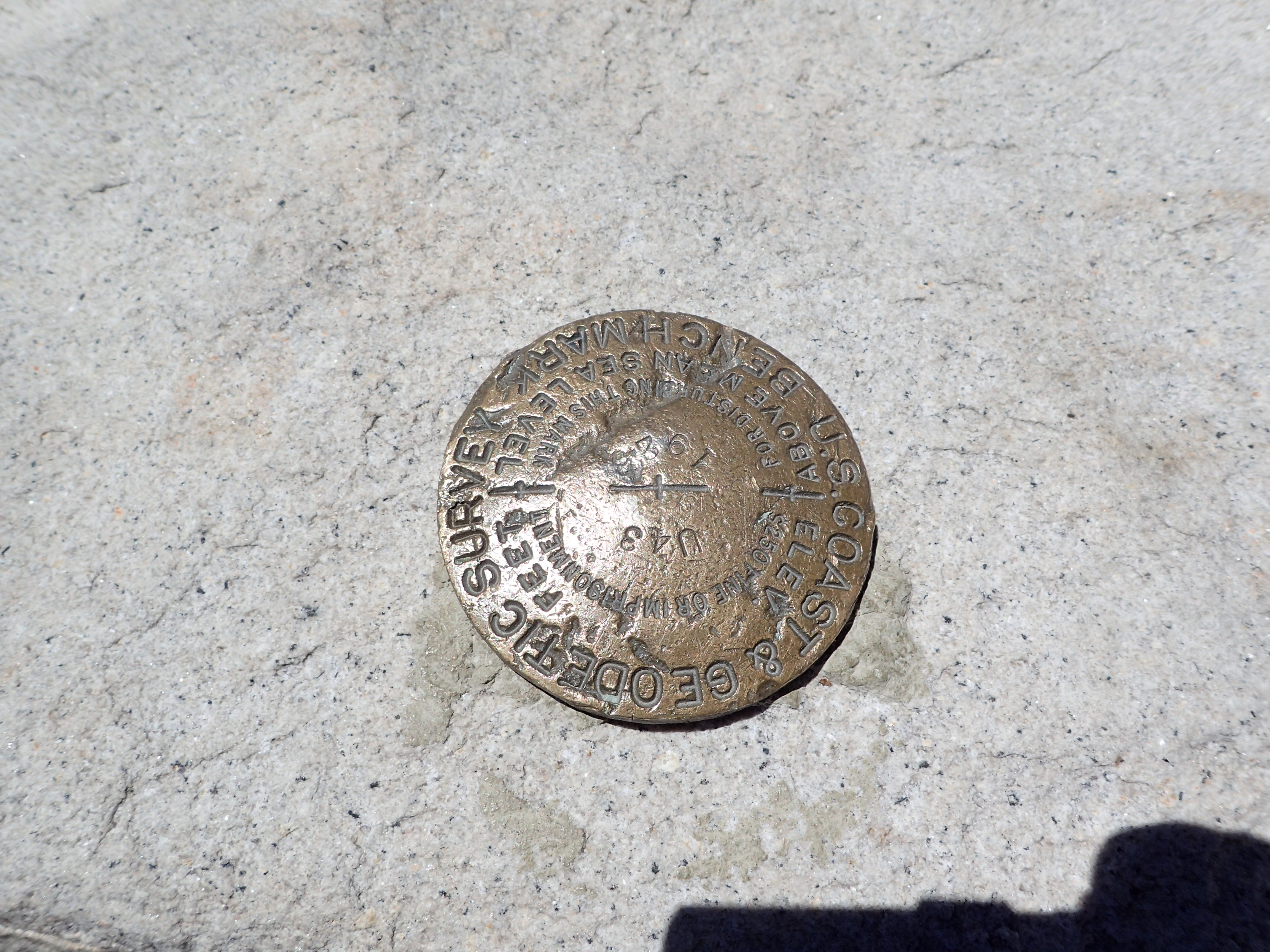
One of several summit markers on the summit.
After relaxing on the summit for a while and chatting with others we decided to make our way down before it got any later. The way down was pretty uneventful and was just a matter of retracing our steps back down. We did however make another stop at Iceberg Lake to take in the view one last time before we left. It was hard to get up and leave such a beautiful place but unfortunately we were getting quite hungry and were really looking forward to a warm meal! However, as I mentioned above once we noticed our mistake in passing the sign for Lone Pine lake, we decided to remedy that by making one last side trip. It turned out to be a great decision as Lone Pine lake is perhaps one of the most beautiful and scenic lakes I have ever had the pleasure to see. It would be a great place to hike up to just for the afternoon if you were not able to get a permit to continue the climb up Whitney. After lingering one last time at Lone Pine lake we worked our way back down to the trail head and finished as it was starting to get dark at about 7 pm, 14 hours after we had started.
It felt great to finally summit Mt. Whitney, the highest point in the contiguous United States at 14,505 ft. Especially since I had been dreaming of completing it since I first set my eyes on the mountain last year after a trip to Death Valley and the Whitney Portal. It wasn’t a technically demanding hike but it was still a long day packed full of plenty of miles, switch backs, and great experiences. The views are simply breathtaking and something that everyone should try to see if they are able. The pictures do not really do the mountains justice. It was also nice that I had the added bonus of going from the lowest point in the western hemisphere to the highest point in the contiguous United States within a day of each other. Now doing that on foot would really be something! By the end of the day I was still feeling pretty good but I had made the disastrous mistake of not applying sunscreen or wearing a hat so I ended up with really awful sunburn. Don’t be like me and make a similar mistake! I have to say it was pretty bad for a couple of days but luckily it didn’t effect the rest of my trip too much. Now I just need to make it back at some point for a winter ascent. As always if you have any questions please feel free to comment below or send me an e-mail as I would be happy to help if I can. I purposely left out a lot of the details as the hike really is quite straight forward and besides the general issues of length and altitude it is not a difficult hike to figure out. Come prepared and you should have a great time just like we did!
Also please be sure to check out my partner Stav’s photo blog HERE for more awesome pictures from our trip.
Categories: California, National Parks, Trip Reports, Wild West

