
TRIP REPORT: Hurricane Mountain – Adirondacks, NY 9-20-15
Hiking stats at a glance:
6.8 Miles Total
~4 hours total
~2,000 ft of elevation gain
1 peak, Hurricane Mountain 3,678 ft
For the second day of our trip we got a late start so we decided to just enjoy a delicious breakfast at the ADK Cafe before setting off for another shorter hike. We settled on hiking Hurricane Mountain which is right outside of town and less then a 7 mile round trip. Although Hurricane Mountain is not one of the recognized 46 High Peaks it is still fairly tall for the area at 3,678 ft and has a bald summit offering beautiful views of the Great Range and other High Peaks. All of these factors combined make Hurricane a great choice for a short day hike, especially if you are looking to avoid some of the crowds on other peaks this time of year.
Also lucky for us the rain from the night before had cleared up by the time we finished having breakfast and we were greeted by a cool, sunny, and beautiful day to be hiking in the Adirondacks.
After breakfast we drove over to the trailhead and parked along the road in front of the trailhead. Just be careful when your parking here as cars do tend to zip by pretty fast and there is no official parking lot. We packed up our gear and hit the trail at about 11 am.

Sign marking the trailhead from the road.
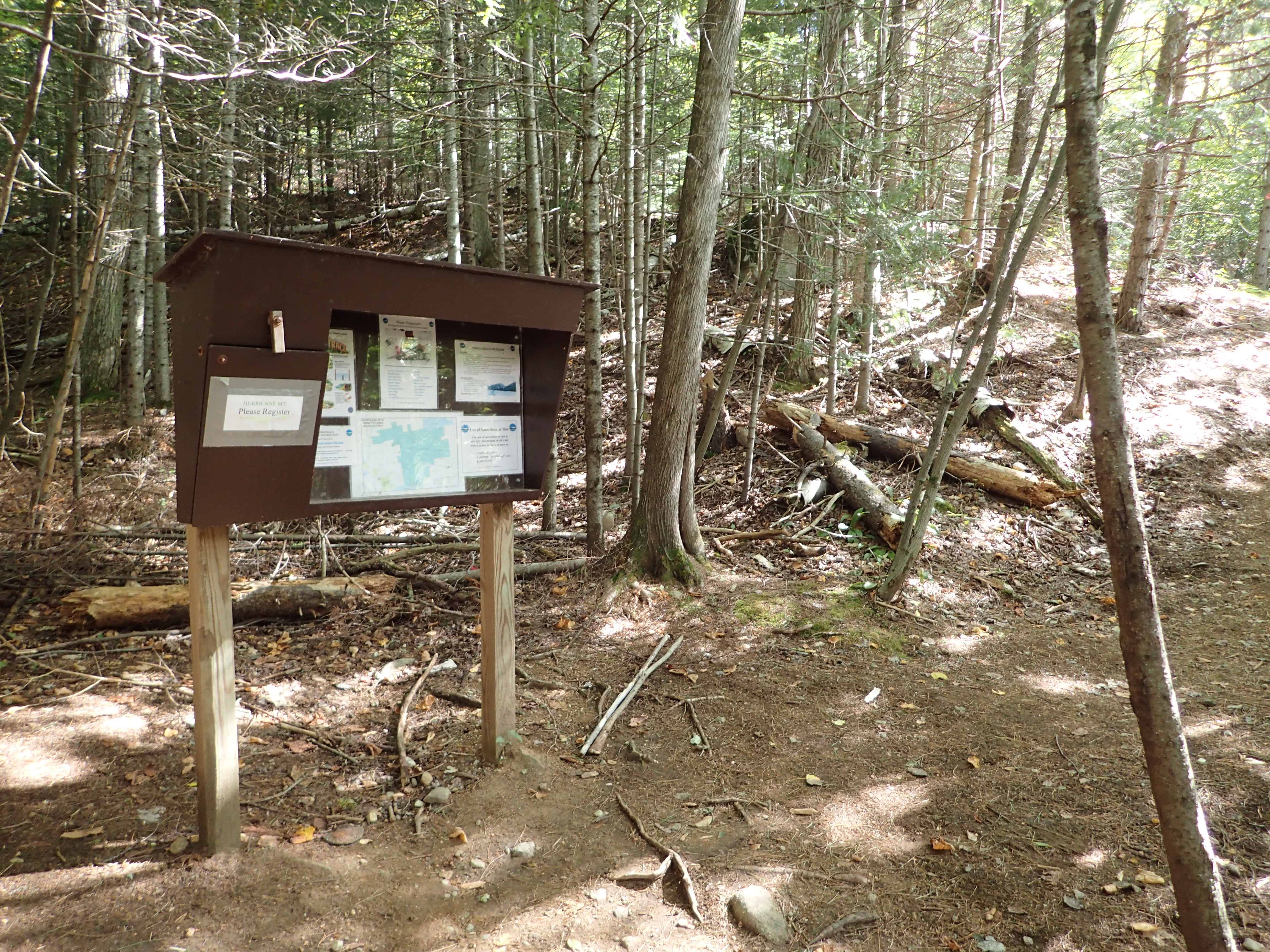
Trail register at the start of the trail.
The trail itself is in great shape, especially compared to some of the more heavily traveled peaks. The trail is mainly hard packed dirt with very minimal rocks and boulders on the trail to navigate. The quality of the trail would make it a good option for some steep trail running in my opinion. Similar to hiking a peak like Cascade, the trail is not terribly long but does ascend roughly 2,000 ft in a relatively short distance. I should also note here that the mileage listed on the National Geographic Trail map is actually incorrect and the trail up to the next trail junction close to the summit is actually 3.1 miles as opposed to 2.5 miles as notated on the map.
The trail begins by winding its way up a series of small switch backs as you make your way up the first steep section before reaching the small flat plateau at the top of the ridge.
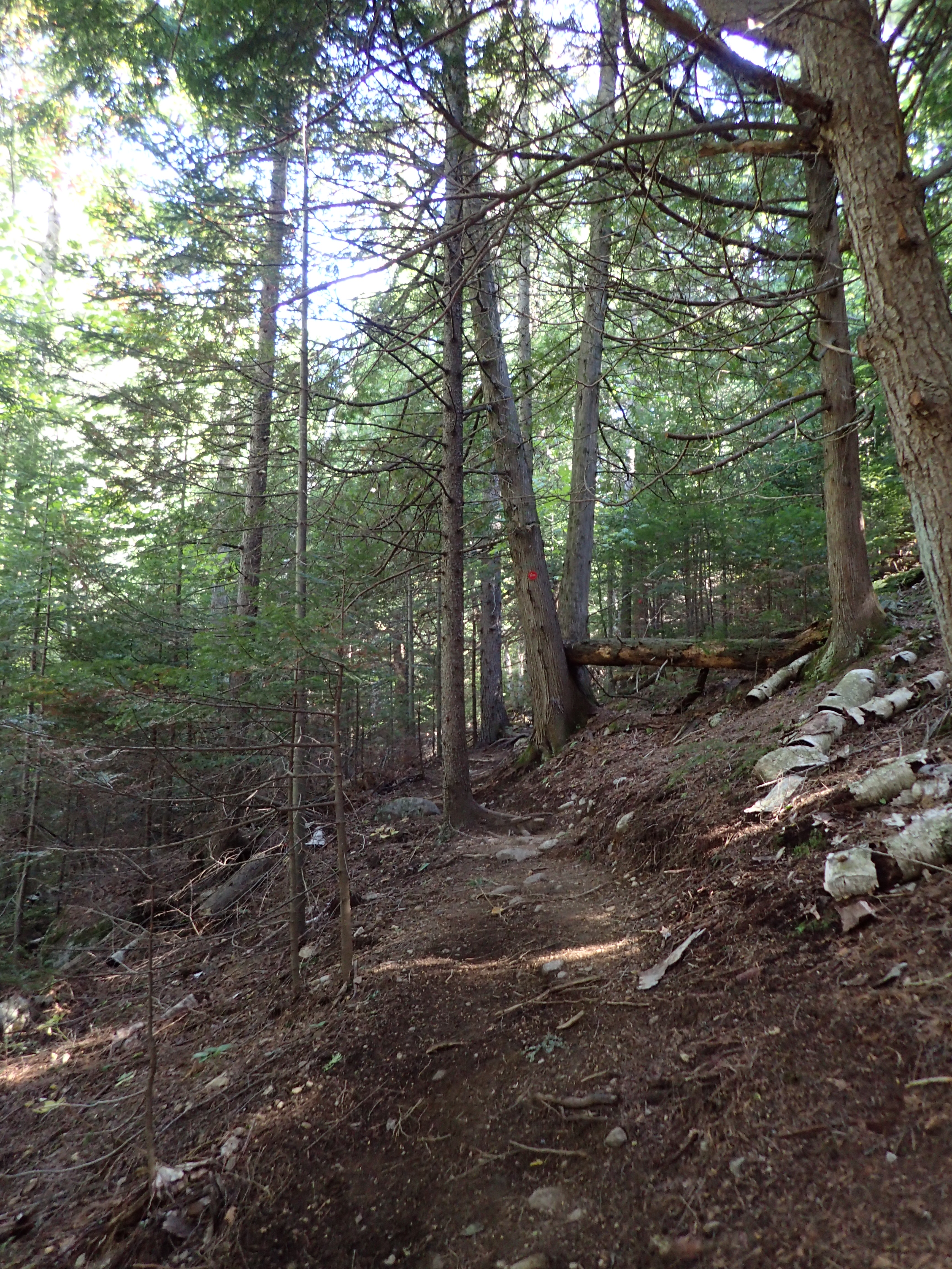
The start of the trail up the series of small switch backs.
After only a short ways of hiking you come to a small clearing in the trees which offers some mostly unobstructed views of the smaller peaks across the road from where you began the hike.

First view of the day.
After passing the first overlook we made quick progress up the trail and in short order reached the top of the first ridge which opens up on to a plateau which is covered in beaver ponds. This part of the trail was unexpected and I have to say that I was pleasantly surprised by how beautiful it was. This section also has wooden plank bridges in place so you do not have to worry about getting wet and muddy passing through the ponds.
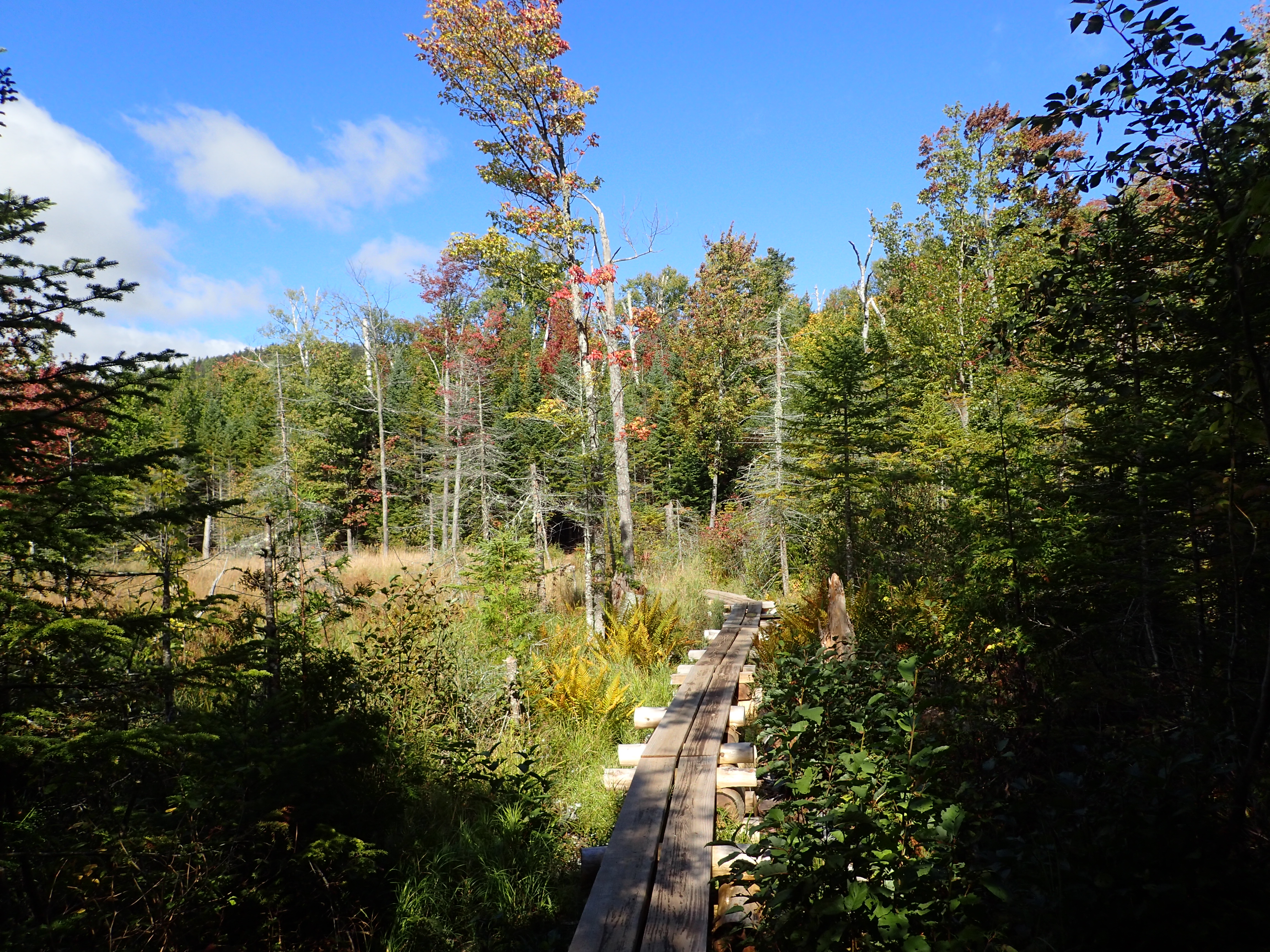
Plank board trail leading over the wetland.

Some trees were beginning to show some color.

Looking out onto the pond.
After a short hike through some flatter areas you begin working your way back up the second ridge which leads towards the summit of Hurricane Mountain. This part of the trail was pretty easy as well and we made efficient work of getting up the ridge before reaching the next clearing along the way. From this clearing we got our first view of the actual summit of Hurricane Mountain.

Second open overlook as you near the summit.
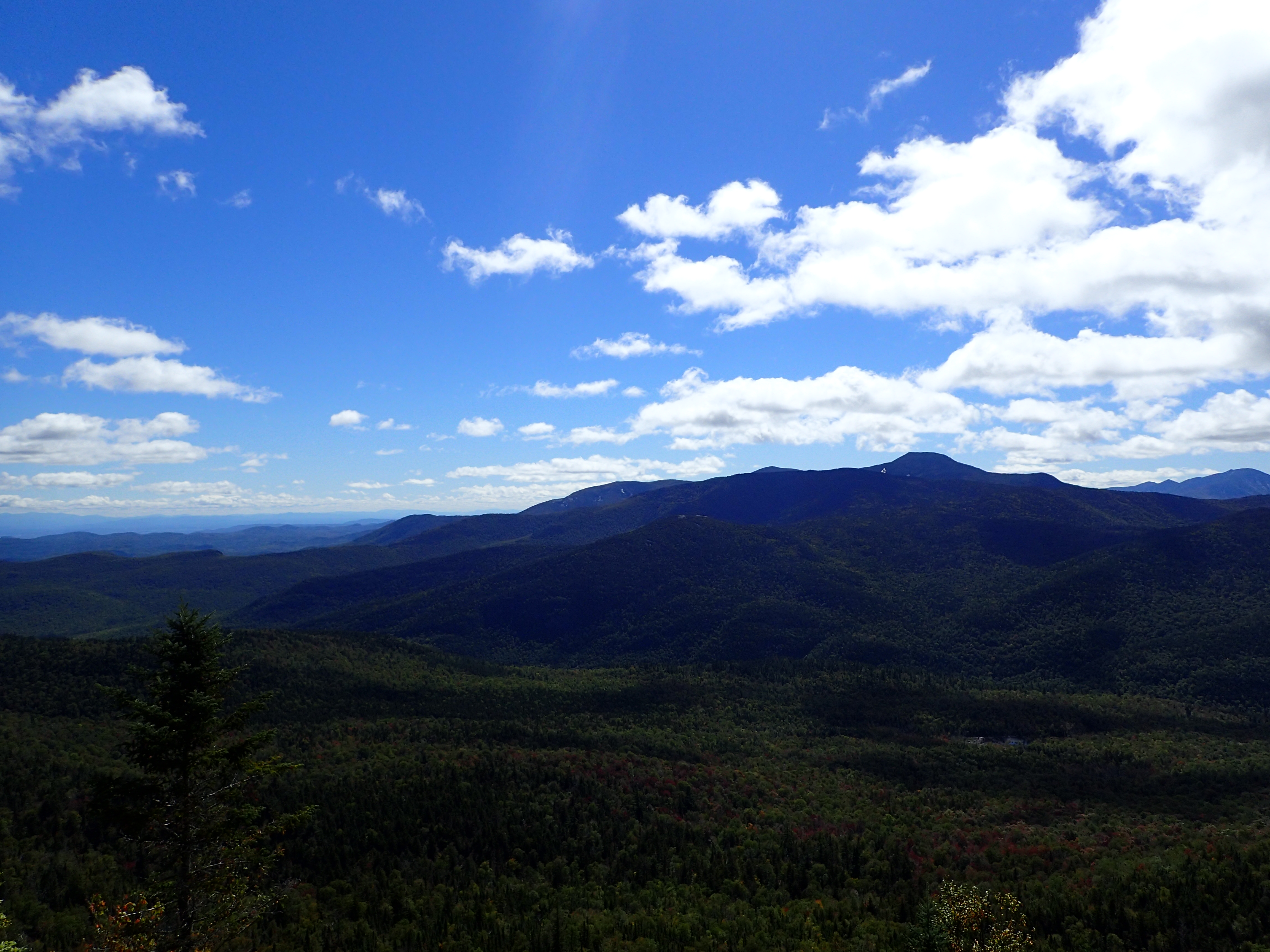
View looking out from the second overlook.
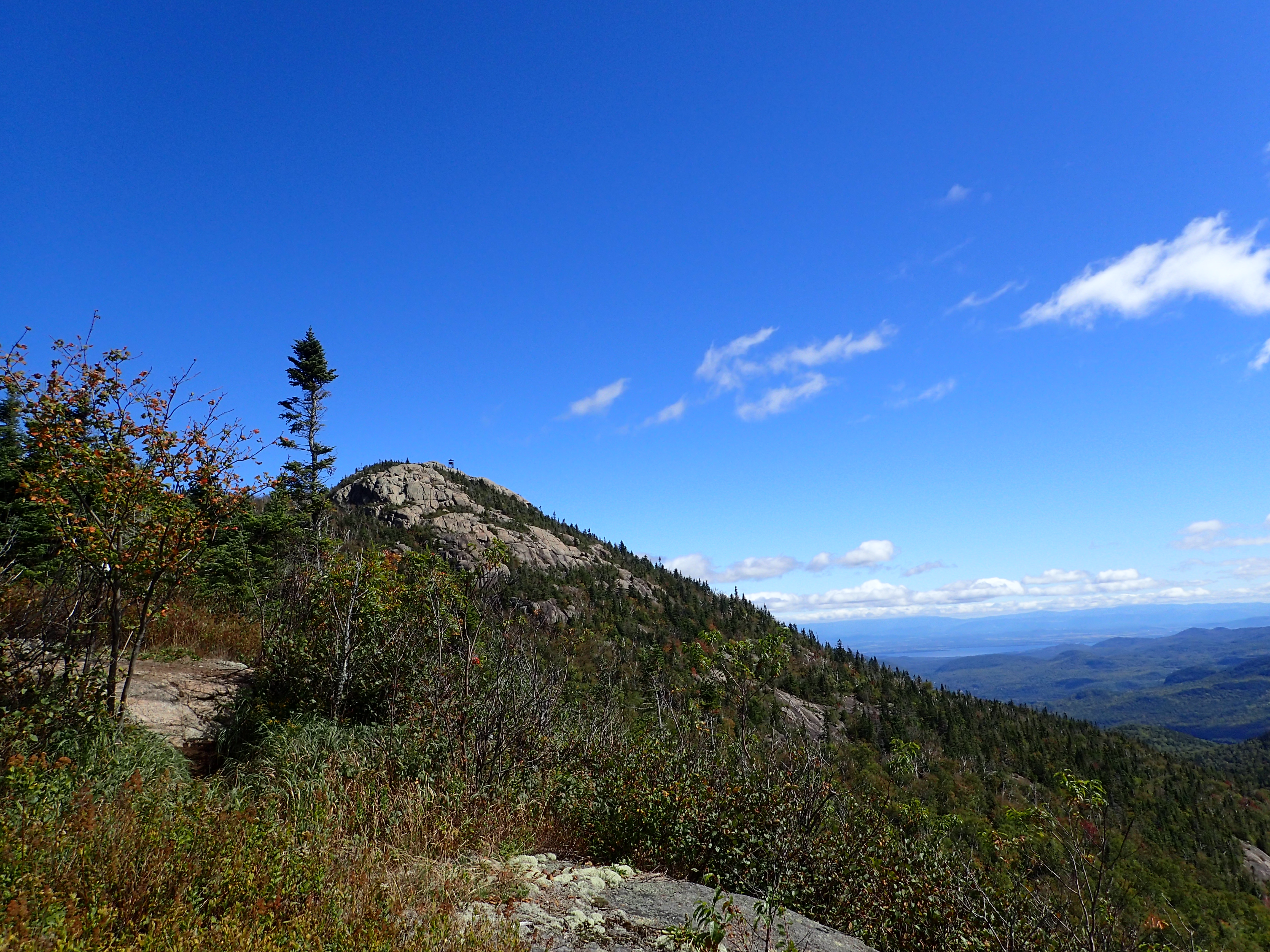
Looking over to the summit of Hurricane from the second overlook.
From here the hike moves along pretty quickly as you make your final approach towards the summit. Also at this point you can tell you have made it up above 3,000 ft in elevation because the vegetation begins to change and looks more like what you see on any of the other official 46 peaks. After a short hike up the ridge from the second overlook we reached the trail junction marking the final 0.3 miles to the summit of Hurricane.
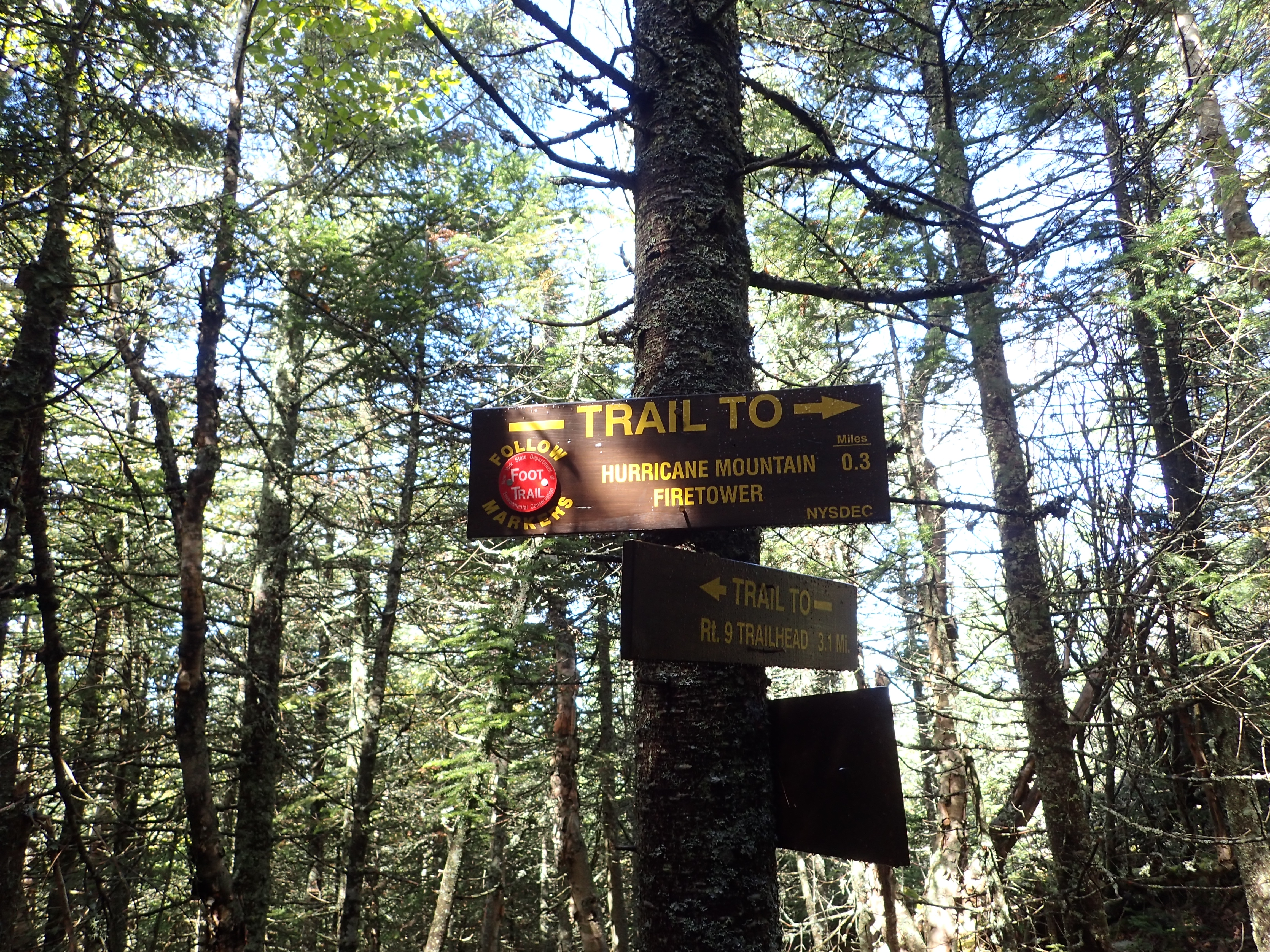
Trail junction marking the last 0.3 miles to the summit.

Junction sign marking the mileage back to the road at 3.1 miles as opposed to the 2.5 miles noted in the National Geographic map.
From this point it is just a short hike up a rocky ridge to the summit. This part of the hike is fun and only adds to the overall experience of this great little hike.
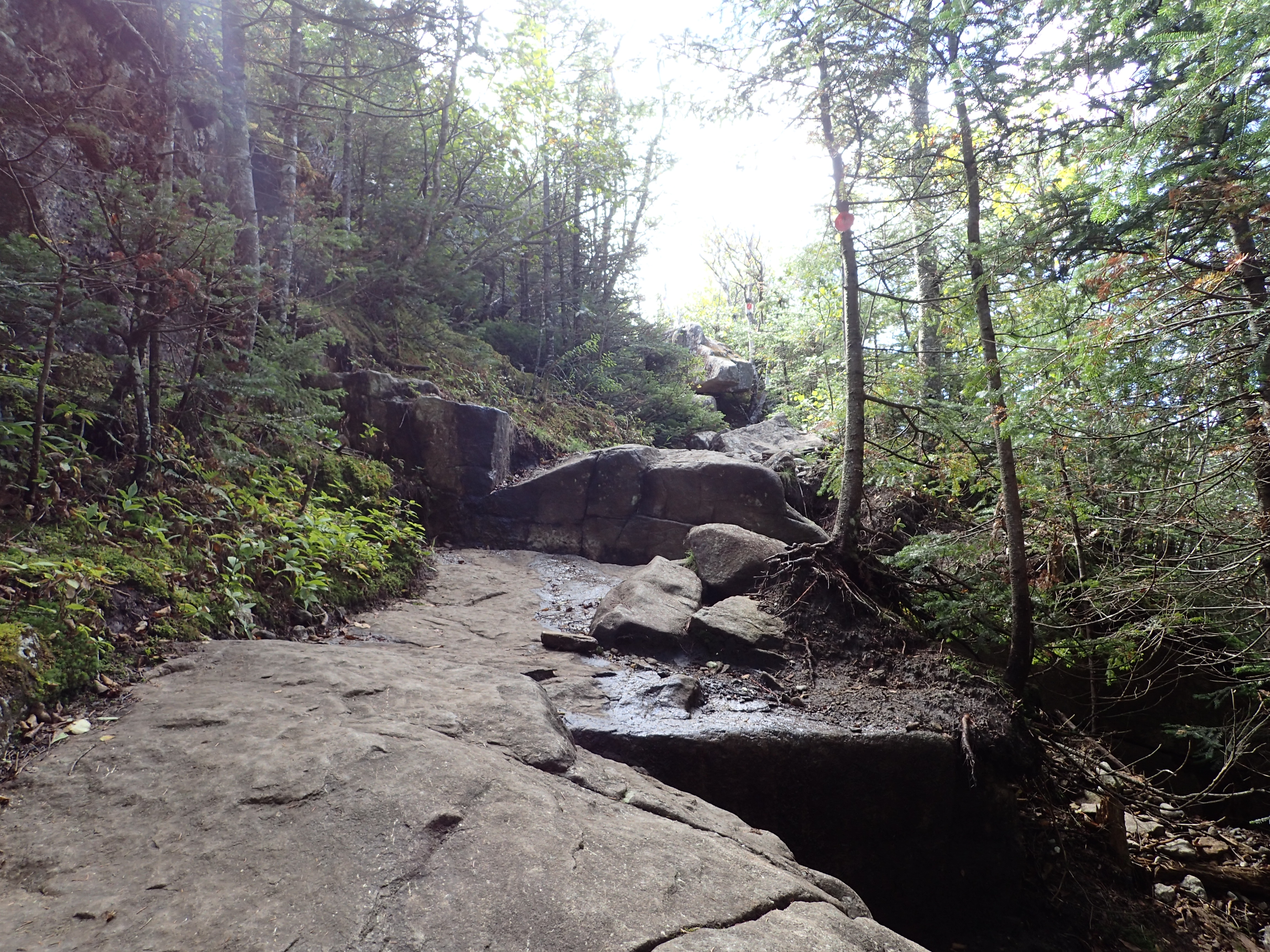
Rocky slab leading you out of the trees.
Final approach on the exposed slab to the summit.
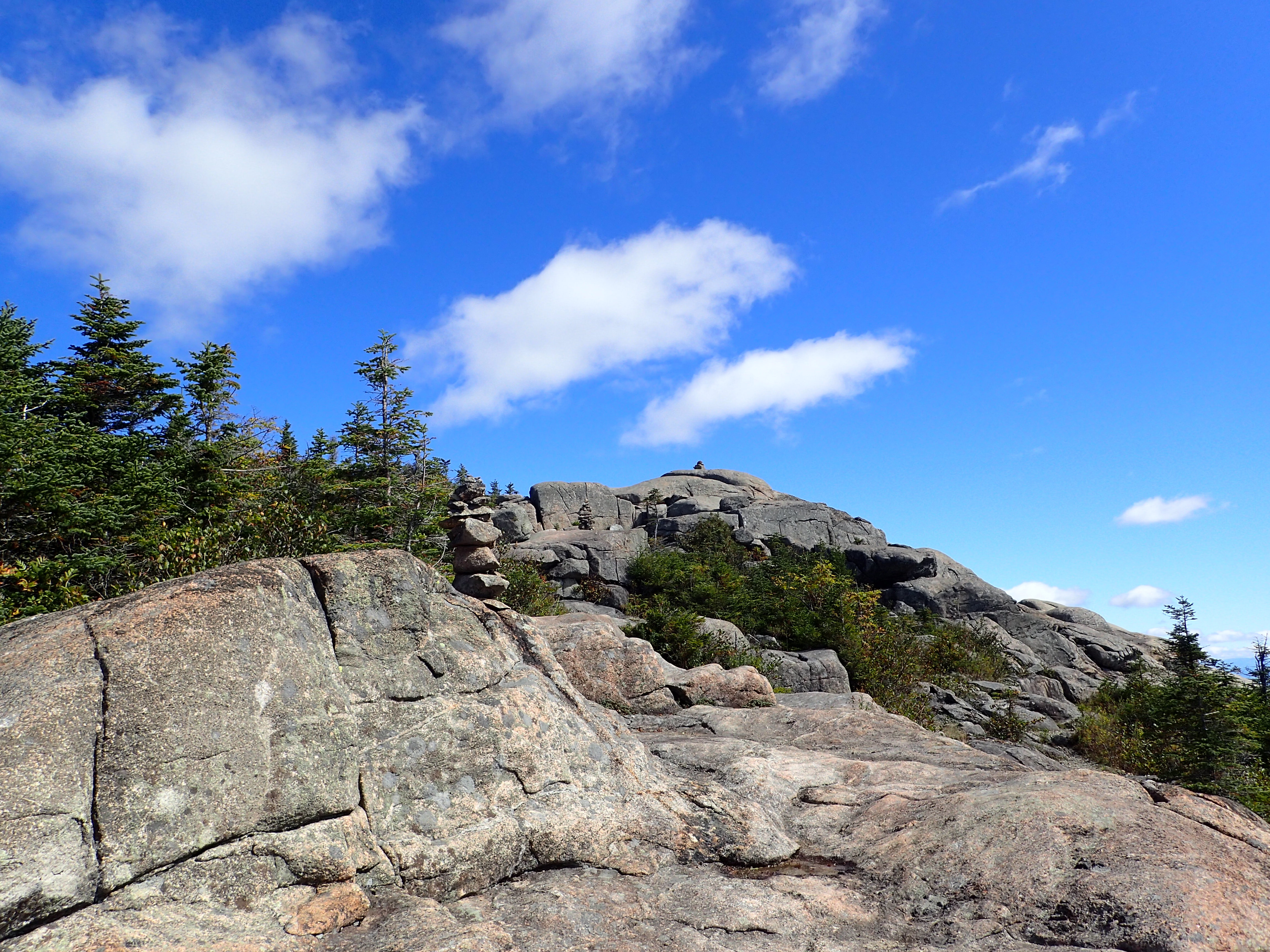
Once up on the summit we were greeted by beautiful blue skies and a cool breeze. Originally I picked this hike to do because it fit our schedule nicely but I did not really expect it to be that fantastic, although I had heard it was nice in the past. I have to say in the end this was really one of my favorite hikes as far as bang for your bucks goes, and certainly more enjoyable than many of the official 46 peaks (Blake and Couch I’m looking at you). The views we got were incredible and it couldn’t have been a better day in terms of weather.


View from the summit of Hurricane Mountain.
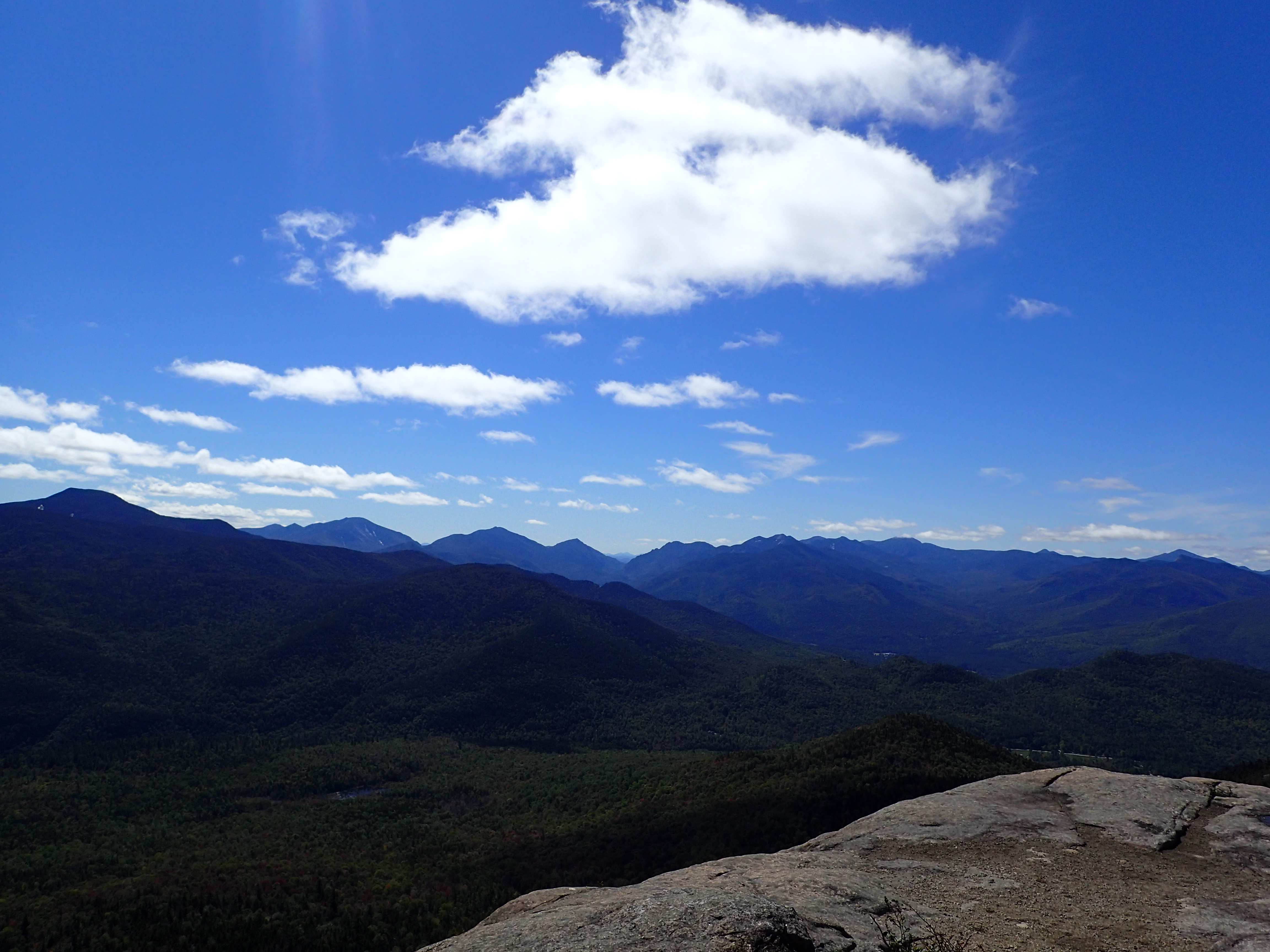
View from the summit of Hurricane Mountain.

Looking out towards Vermont from the summit.

USGS marker on the summit of Hurricane.
In addition to the beautiful views from the summit there is also an old fire tower which adds a bit of history to the peak, and does not distract from the experience. There are also bundles of building materials located near by for the planned renovation of the tower as it had fallen into disrepair but is now registered as a historic landmark.
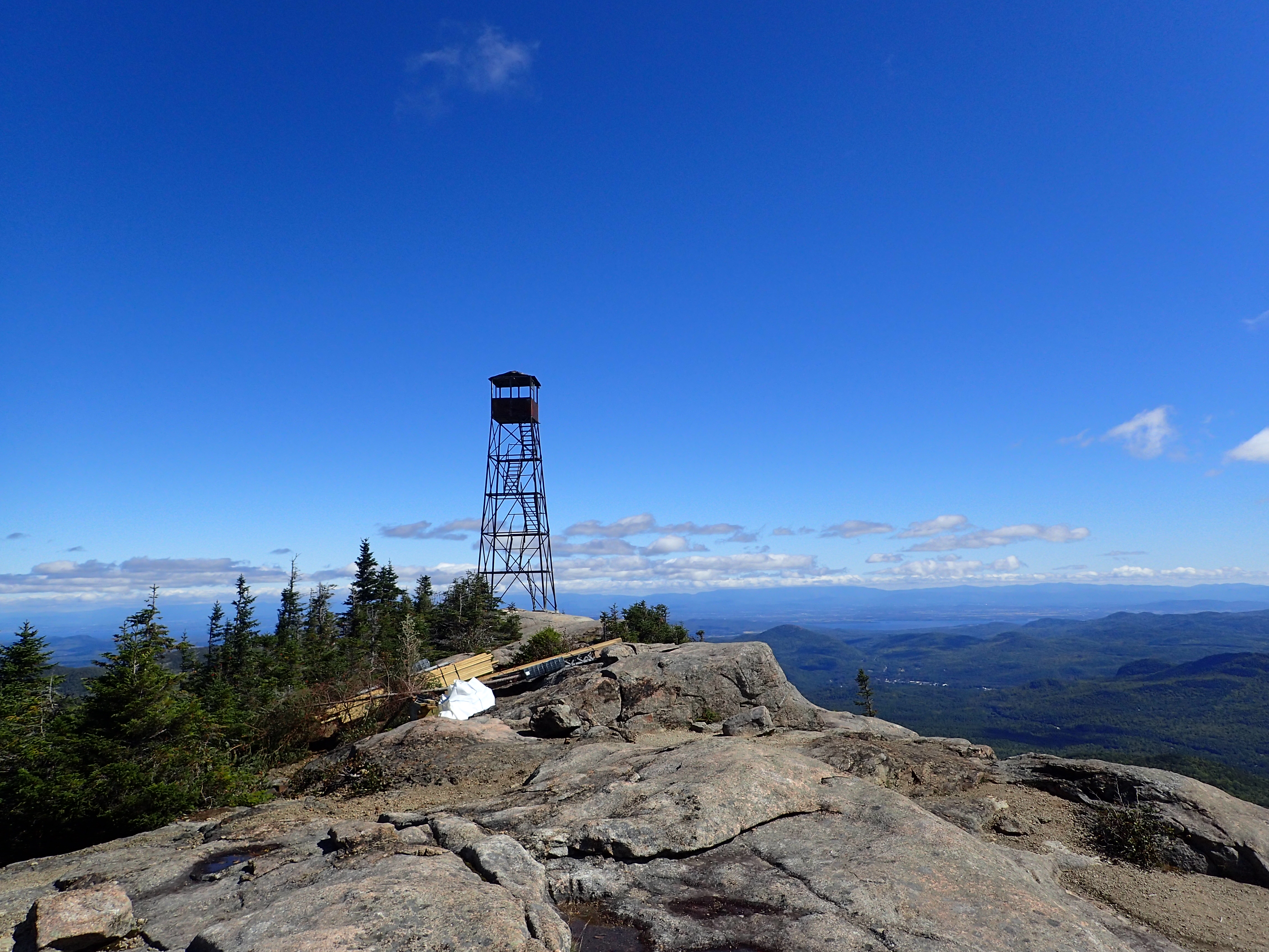
Old fire tower on the summit in addition to building supplies for the upcoming renovation of the tower.
After spending about 40 minutes enjoying the sunshine on the summit we made our way back down to the car. The hike back was uneventful and did not take us terribly long. Before long we were back in the car and headed back home to New Jersey.
All in all the hike up Hurricane Mountain was a great experience that I really enjoyed. Even though Hurricane is not on the official list of 46 High Peaks, it is still certainly worth hiking in its own right. Don’t sell yourself short by missing this gem only because it isn’t on the list. Although maybe I shouldn’t be selling it so hard because it was nice to be on a peak that was so quiet, especially for this time of year. The hike up Hurricane is also mellow and short enough that I would absolutely recommend it for hikers of all abilities in addition to people just looking for a short, sub 5 hour hike.
Categories: Adirondack High Peaks Region, Trip Reports


Great post! Hurricane was a really fun and unexpected hike with pretty incredible views
Here is some additional info on the work to restore the fire tower at the summit: http://www.hurricanefiretower.org/
Work begins this week on the restoration- they are looking for volunteers!
LikeLiked by 1 person