
TRIP REPORT: Rooster Comb, Hedgehog, LWJ, UWJ, Armstrong – Adirondacks, NY 7-26-15
Hike stats at a glance:
~17.5 miles
~5,700 ft of elevation gain
3 High Peaks – Lower Wolf Jaw (4,175 ft), Upper Wolf Jaw (4,185 ft), Armstrong (4,400 ft)
2 Minor Peaks – Rooster Comb (2,762 ft), Hedgehog (3,389 ft)
9.5 hrs
~80 degrees hot and humid, partly cloudy
After spending the last couple of weeks in the western part of the high peaks I decided it was time to head back to the Great Range. This Saturday I went with a hike up Rooster Comb, Hedgehog, Lower Wolf Jaw, Upper Wolf Jaw, and Armstrong. The only downside to how I did this hike was that it was not a loop but instead a there and back again endeavor. This meant that I would have to climb Upper Wolf Jaw, Lower Wolf Jaw, and Hedgehog twice in the same day adding quite a bit to the elevation gain total for the day. However, despite all of that I knew this was a good choice for training purposes.
Overnight it had been very cloudy and the forecast called for rain, but if it did rain I never noticed.I woke up at 5am and the morning brought cool temperatures in the mid to high 50’s and some fog hiding the sunshine. I spent some time preparing my things for the day and talking to some others at the trailhead before finally signing in at the register and beginning my day at 6am.
The first part of the trail is extremely pleasant and resembles more of a walk in a county park than it does a wilderness trail. I even got a nice view of fog rolling over the mountains behind the pond. It was a nice and refreshing way to start the day.
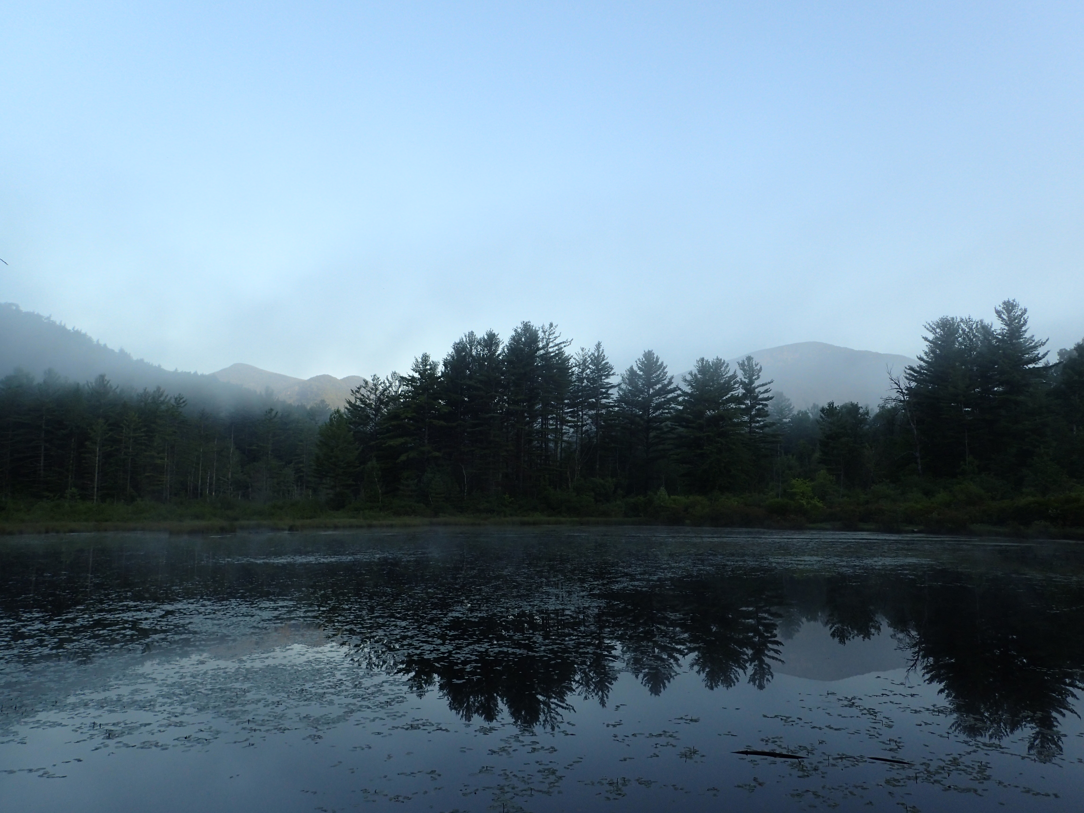
Fogging rolling past first thing in the morning.
The trail works its way up the hill towards Rooster Comb at a very easy incline with little to no rocks or roots on the trail. The easy start makes for a nice warm up early in the day. Before I knew it I had already covered the first 0.7 miles to the first junction. From here you can either go left towards Snow Mt. (which I would like to come back to do) or continue right towards Rooster Comb and Lower Wolf Jaw (LWJ), I continued to the right.

First trail junction
It was at this point that the sun started to peak out onto the hill and as a result started to wake me up a bit. I didn’t have my regular dose of caffeine this particular morning so I was not quite as perky as usual but warm sunshine and activity work well to snap you out of it.

Sunshine peaking through
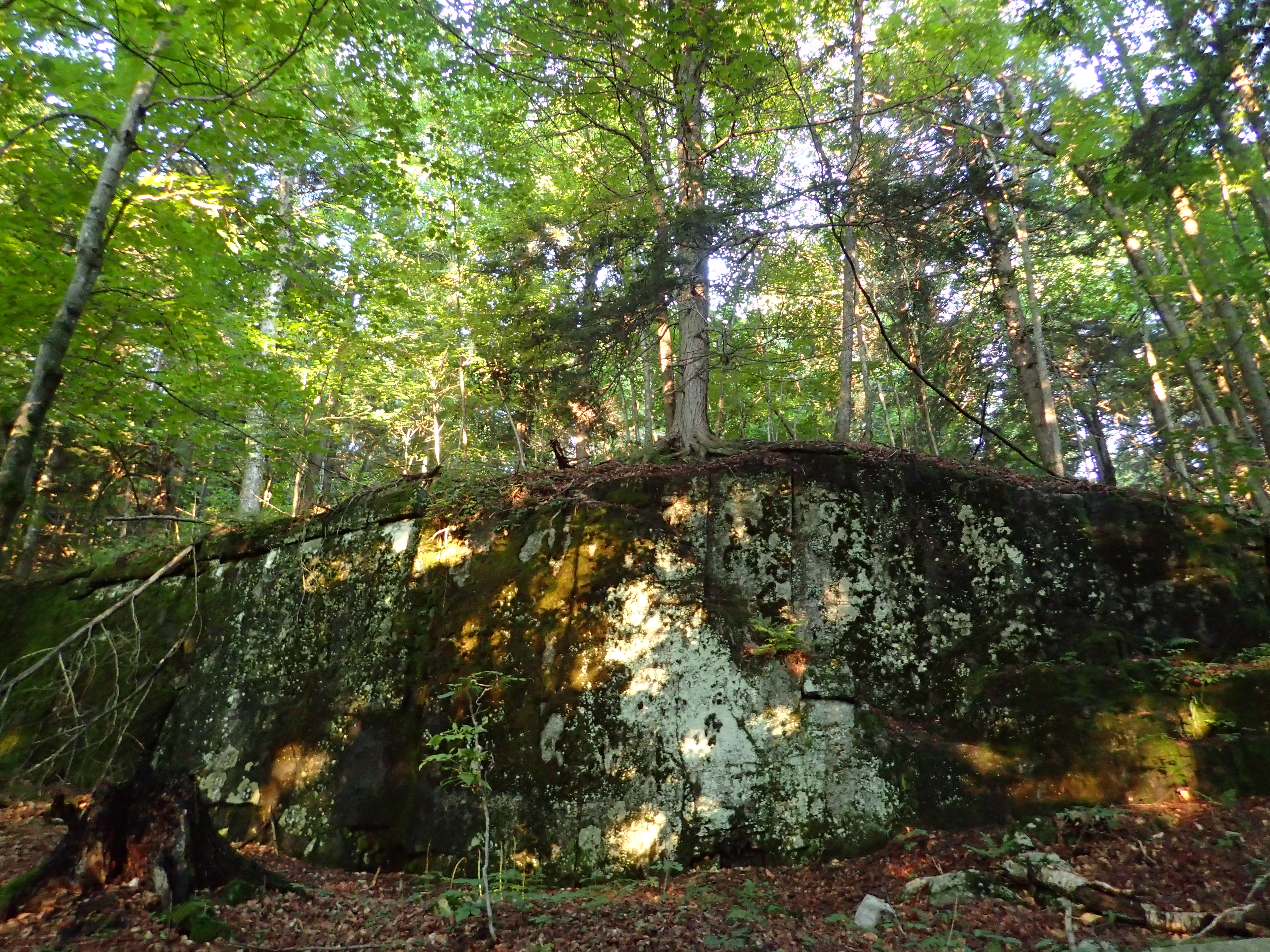
The small rock outcroppings within the open forest add to the ambiance nicely.
By 6:51 I had made it the first 2.0 miles to the Rooster Comb trail junction. From here it would be just 0.5 miles to the summit of Rooster Comb. Despite it being such a short side trip, I made the decision to save this part for last. I knew it would be nice to enjoy the views one last time before returning back to the car. As a side note I will also add that this hike from the parking lot up to Rooster Comb would be perfect for anyone who doesn’t think they can make it up a high peak but would love some beautiful views. It is a mellow and easy trail to follow but still offers amazing views (something that cant be said about quite a few of the 46 High Peaks).
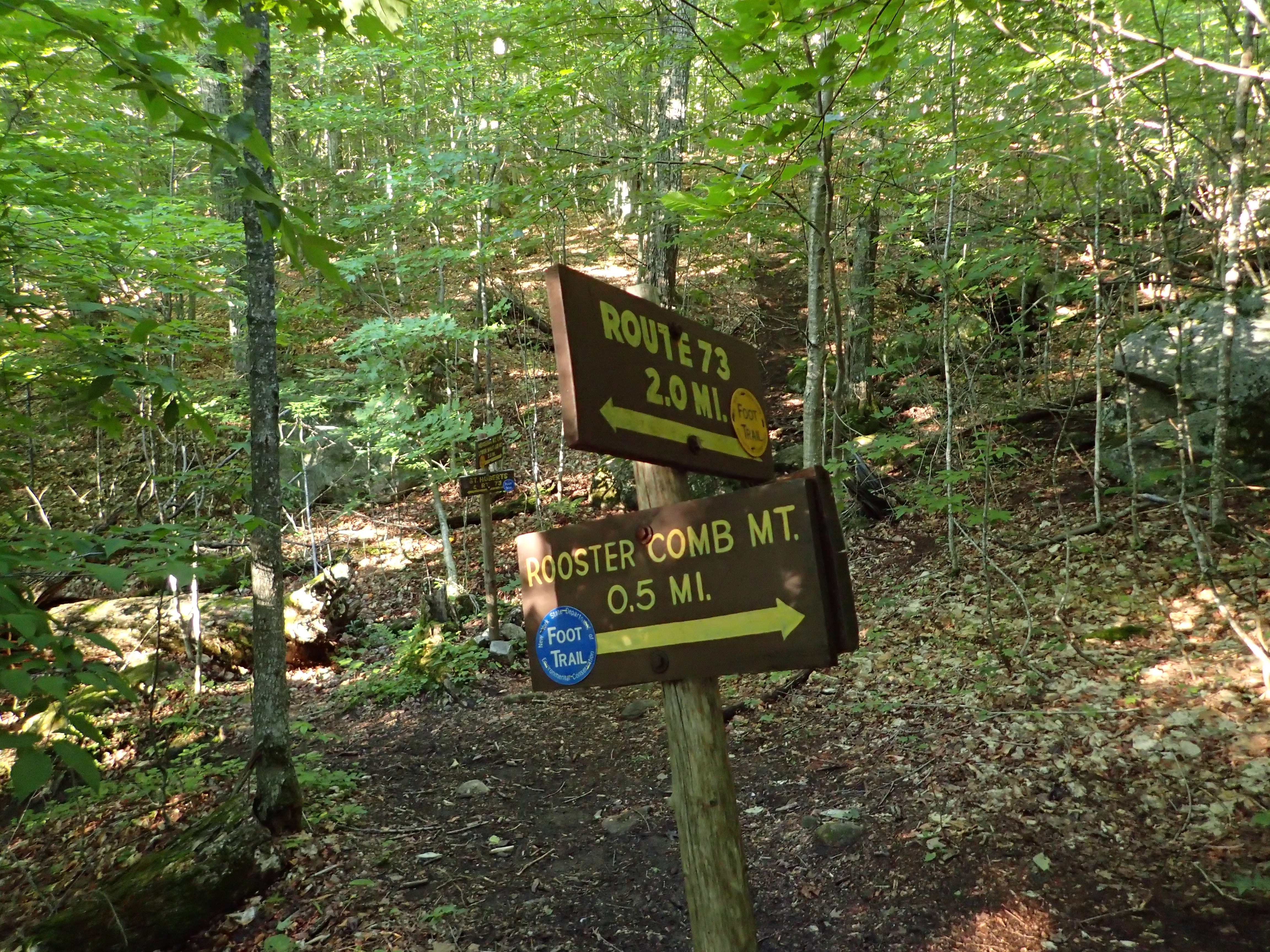
Junction for the Rooster Comb trail
After making my decision to continue on for now I walked a little ways further to the next sign which marked the trail that continued on to Lower Wolf Jaw. From here it would be another 3.0 miles to the summit of LWJ in addition to having to go up and over Hedgehog Mt.

Onward and Upwards
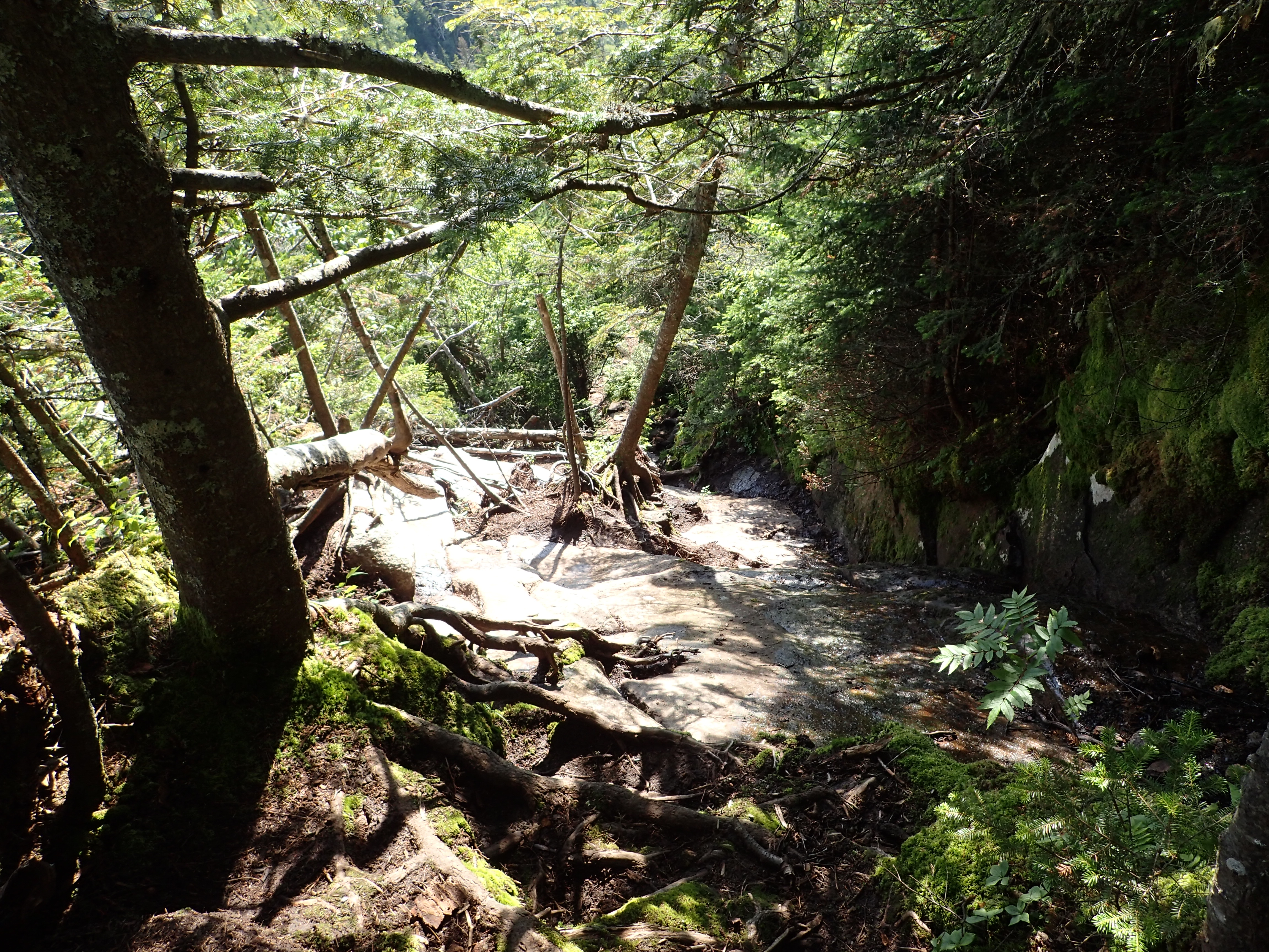
At this point the trail starts to resemble your average High Peaks trail, complete with plenty of rocks, roots, and mud. The first part of this section takes you up and over Hedgehog Mt., an event that I honestly didn’t even notice until I was already on the other side of the mountain. The uphill climb and downhill on the other side are fairly gradual so it is pretty easy to miss the fact you climbed this mountain at all. I have included a photo of what I think is most likely the summit of Hedgehog, although there is no sign or marker to tell me I am right.

The kind of Adirondack trails we know and love
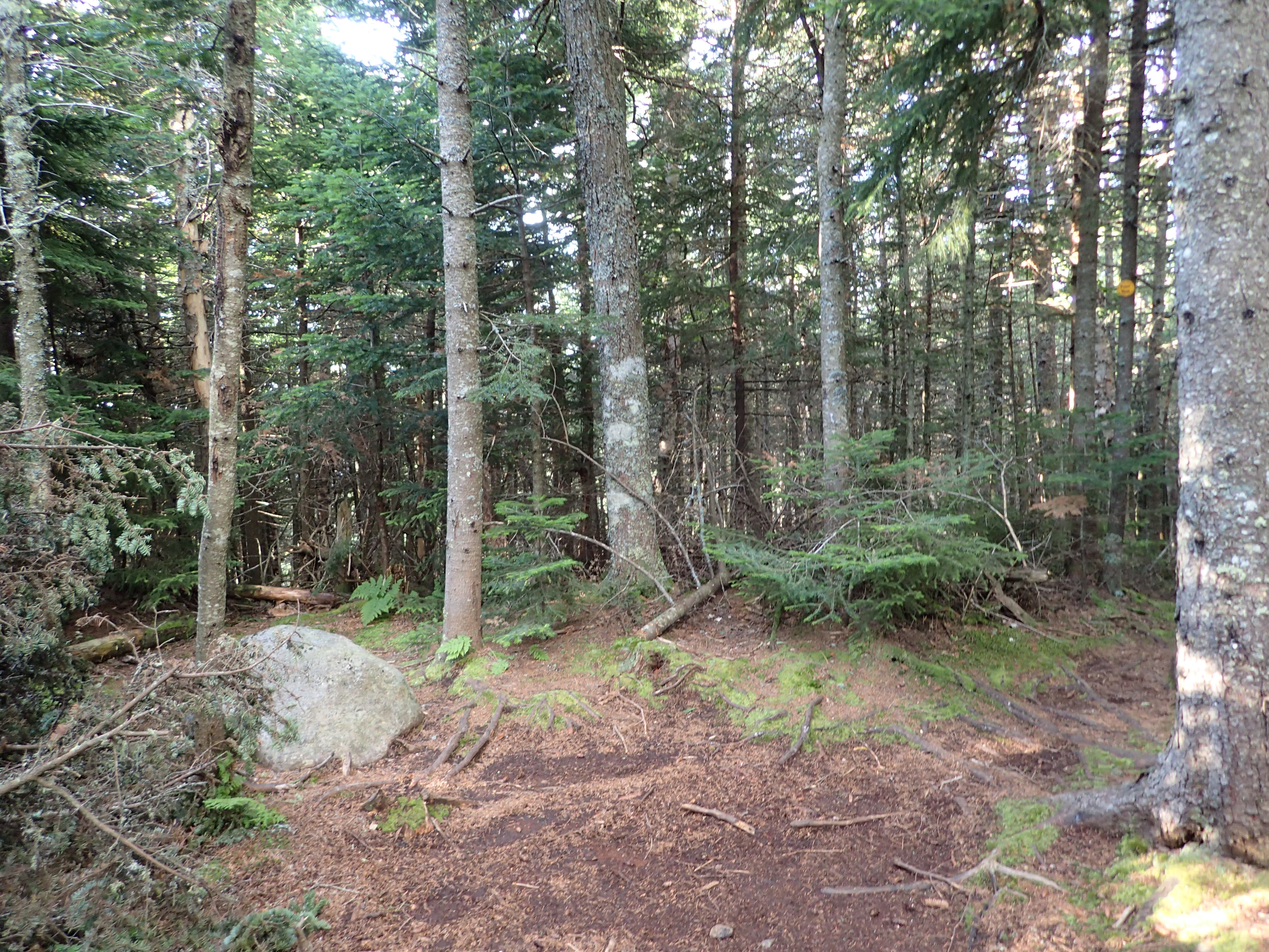
What I believe is most likely the summit of Hedgehog
Once down on the other side of Hedgehog you end up in the valley with Lower Wolf Jaw, which is another 1.5 miles uphill. At this point the trail becomes a bit steeper and more rugged as you make your way up the flank of Lower Wolf Jaw. I reached this junction at 7:48 am

The steeper section begins after this sign.

The sign that let me know I had climbed Hedgehog without realizing.
The trail leading up to Lower Wolf Jaw was pretty mellow and it was your standard climb up a gully stepping up small ledges and roots. There was very little to no mud on this or any part of the trail this day. Whatever mud you did run across could be easily avoided. This type of trail continued for most of the way until you come to the one and really only steep section on the trail near the top. This short slab section was fairly steep and inside the corner was extremely wet.

Looking up the steep part
At first the safest route up is not immediately obvious but if you follow the path of least resistance on the right side after a few feet you will see a path cutting into the trees on your right. This well worn path, complete with plenty of trees and roots to grab if you so desire, eliminates having to negotiate the wet, muddy, and potentially dangerous slab. There is certainly more than one way up this section so just take your time and use your best judgement on what would be best given the conditions.
Looking back down the steep section
Once you get a little bit past this section you are more or less on the summit ridge. It was at this point that I got my first views of the day. Lucky for me the storms that were supposed to come in the afternoon were still not materializing.

First view of the day.
After just a few more minutes of traversing the ridge on easy terrain I reached the wooded summit of Lower Wolf Jaw at 8:43 am. The summit of LWJ is rather underwhelming as there are no unobstructed views or otherwise particularly interesting features. There was just a sign pointing towards Upper Wolf Jaw so I did not linger long and was on my way.

Trail on summit of Lower Wolf Jaw point the way to Upper Wolf Jaw
The trail leading down off this side of LWJ was pretty easy, although kind of steep. It generally just involved negotiating short sections of rock ledges, without any real large or particularly steep slab sections. I did not stop to take any photos in this section so I was able to do the 0.5 miles to the next junction in quick time. I made it to the next junction by 9:04 am and stopped to pull out a protein bar and refuel for the next section.

Sign at the junction between LWJ and UWJ
After finishing my snack and chatting with another group of people I ran into I was on my way up to the summit of Upper Wolf Jaw. This 1 mile section of trail was fairly steep and more difficult than the trail up LWJ. It involves a fair bit more scrambling in sections although there is nothing very hard or dangerous. The trail winds its way steeply up the path of least resistance on the mountain.

Just one of the many ledges requiring negotiating.
As you get a bit higher up the side of UWJ out of the valley below you are greeted by great views of LWJ behind you. I always think its fun to look back and realize just how far you have come in such a short time.
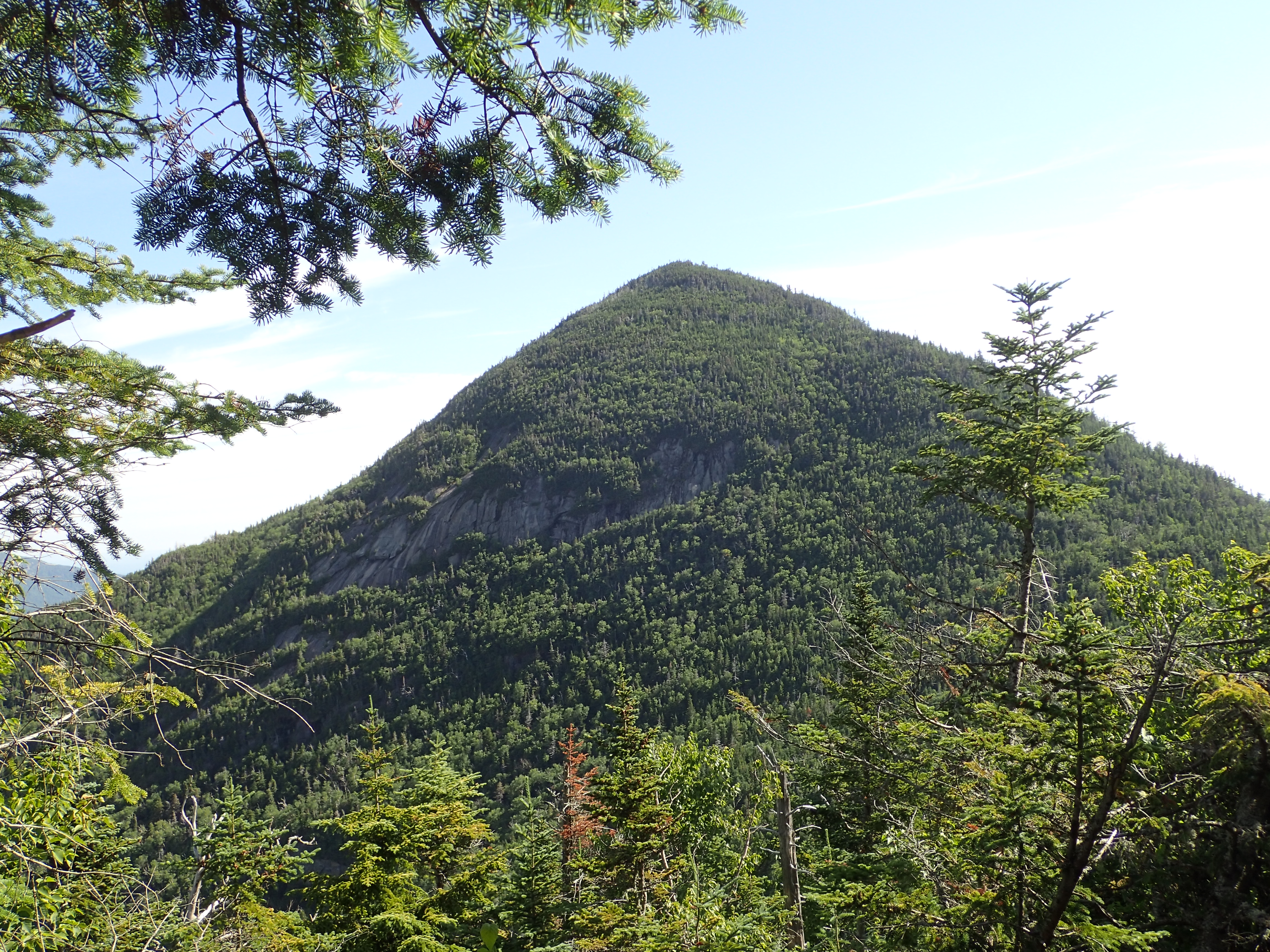
Looking back on Lower Wolf Jaw
The steep section continues for a little ways until you find yourself up on the summit ridge. You will know you are getting close once you run into this big boulder, which if it doesn’t already have a name, probably should.

Big nameless? boulder
After hiking a little ways along the easy path on the ridge you find yourself at a small junction with a small sign marking the path to your right 20 yds to the Upper Wolf Jaw summit.

Sign marking the summit of UWJ.
The summit of Upper Wolf Jaw is actually wooded as well, but there is a large boulder to stand up on which offers unobstructed views to the south and east. I made it to the summit at 9:47 am and it was now beautifully bright and sunny. There were also little to no bugs which was the perfect combo for enjoying the beautiful views.

View from UWJ

View from UWJ
I lingered for a little while before getting back on the trail and working my way to Armstrong, my last peak of the day. It is only a 1 mile trip from UWJ to Armstrong but it is considerably steeper and technically difficult in my view than the rest of the trail up to this point. At no point would I say its too hard or dangerous but comparably I think it would challenge most people a bit more than the rest.
Most of the trail is very similar to the one on UWJ but with the addition of a few more obstacles that are a bit more dramatic. The first one of these obstacles is of course the famous or infamous ladder.

The famous ladder on Armstrong from UWJ
This is of course just a simple ladder and it is easy to travel without any real trouble. Although I have heard that in the winter it tends to turn into a big icicle.

Looking back down the ladder.
Once past the ladder you do a bit more simple steep hiking until you reach what I thought was another major obstacle. It is a short rock face without a ladder that needs to be climbed. There are plenty of ways to climb this thing but I had opted on going right and then up and over, traversing the top. This way proved fairly easy but I am not sure I would recommend it for anyone who is wary of heights or carrying a heavy pack. Alternately I saw a couple of groups stay to the left which appeared to be a lot easier and safer route. I ended up using that way on the way down and I would probably agree. Ultimately hiking in the Adirondacks is a choose your own adventure book and your personal mileage will vary!

Short rock face to negotiate
Once past these obstacles it is a fairly quick walk to the actual summit of Armstrong on your right on a small outcropping. I was standing on the summit of Armstrong by 10:34 am. I was rewarded on this summit by some of the best views in the High Peaks. The views looking out on to the rest of the great range from this vantage are really fantastic. The views were so good that despite the crowds rolling in I took a seat and enjoyed the view for quite some time. Since it was my last major peak for the day I really wanted to soak it in while I could.

View from Armstrong

View from Armstrong, including my not so muddy feet for the first time in weeks!

View form Armstrong

View from Armstrong as the dark clouds roll in
I wanted to stay for much longer on the summit but as the dark clouds began to push in I knew it was time to get a move on. I had enough of getting wet in the Santanoni’s so I figured I would try to beat the storms down this time. Besides I also still had Rooster Comb to revisit on the way down.
Although I had finished all of my peaks for the day, the day was still far from over. Since I wanted to finish back at the Rooster Comb parking lot I would have to climb back the way I came over both Upper and Lower Wolf Jaws which added quite a bit of elevation gain to the day. Since I already detailed this particular route I will not re hash the whole thing but will instead just post a short list of my times at different junctions on the way back for your knowledge. On the way back I stopped mainly to record my times and answer some questions for passerby’s.
- 11:26 – Back on the summit of Upper Wolf Jaw
- 12:00 – Base of Upper Wolf Jaw
- 12:25 – Summit of Lower Wolf Jaw
- 1:08 – Base of Lower Wolf Jaw, with 0.4 miles to Hedgehog and 3.5 miles to Keene Valley
- 1:55 – Rooster Comb trail junction
Once I arrived back at the Rooster Comb trail junction I knew I had just one more stop to go. I worked my way up the short windy trail until I reached a small junction which said 0.3 miles left to Rooster Comb summit or 0.1 miles right to valley view overlook. I decided to just go to the summit first. The trail is easy to follow and although moderately steep it is short and not difficult. Once I reached the clearing on the summit I was greeted by beautiful views of the Great Range and where I had just been. I can see why this little peak would be such a popular destination for a short hike right from town. I stayed for a little while enjoying the views. I also observed the clouds that were getting darker and angrier right over the area where I had just been a couple of hours earlier. Rooster Comb may not be a big mountain but it is certainly worth the time to climb it. The 300 ft cliffs on 3 sides afford you such nice views of the Great Range that really shouldn’t be missed.

View from Rooster Comb

Clouds rolling in over the Great Range as seen from Rooster Comb
After hanging out for a little while I got up and started working my way back to the parking lot below. Also before going all the way down Rooster Comb I stopped to take a look at the valley overlook. This was just a short little patch of rock that looked out over the towns in the valley. It is a nice little stop but not nearly as good or dramatic as the summit of Rooster Comb itself, but it is such a short detour so there is no reason not to take a look.
I was back at the junction of the Rooster Comb trail with the main trail at 2:36. At this point knowing that the trail was relatively smooth I collapsed my trekking polls and ran the rest of the way back down to the parking lot. It was a pleasant run and a great ending to a fantastic day. I reached the parking lot at 3:07 and signed out, completing another great day in the Adirondacks High Peaks.
Categories: Adirondack High Peaks Region, Trip Reports

