
TRIP REPORT: Santanoni Range in One Day – Adirondacks, NY 7-18-15
Hike stats at a glance:
15.5 miles
4,950 ft of elevation gain
3 High Peaks – Santanoni, Panther, Couchsachraga
11 hrs total including stops
~75 degrees, humid, raining, cloudy
———————————————————————————————————————————————————————–
This past Saturday I decided to pick the Santanoni range as my next set of high peaks to climb on my journey to becoming an Adirondack 46er. It had rained all of Friday night but once morning came it was just foggy and damp. I started at the trail head off of Upper Works Rd at 6am, my ideal time to start most long hikes.
The first 4.5 miles of the hike are on a marked DEC trail and is very easy to follow. The first 1.8 miles of this marked trail actually follow a road until you reach the signs marking the entrance of the trail into the woods. This trail marker is easy to spot and is on your right hand side.

Markers leading you off of the road and into the woods.
Shortly after turning into the woods I passed the first water crossing of the day. There used to be a bridge over this crossing but it looks like it had washed away quite some time ago and there is a sign on the trail informing you that it is out. Despite all the rain lately the brook was easy to cross on the rocks without getting wet.

First water crossing and missing bridge.
Continuing on the trail it was pretty uneventful and fairly boring flat trail. Until I came across one of the more amusing things I have seen in the Dacks so far. I came across a bridge with a nice sign warning me that it was a Dangerous Broken Bridge. The sign was perfectly askew to add to the effect. Of course safety is no laughing matter but I could help but be amused. I decided to cross the bridge despite the ominous warning. Luckily the bridge held and I was well on my way. It felt sturdy under my feet except for the last section which was slanted and missing boards. I think it may have been possible to cross without the bridge but I didn’t take the time to look into it.
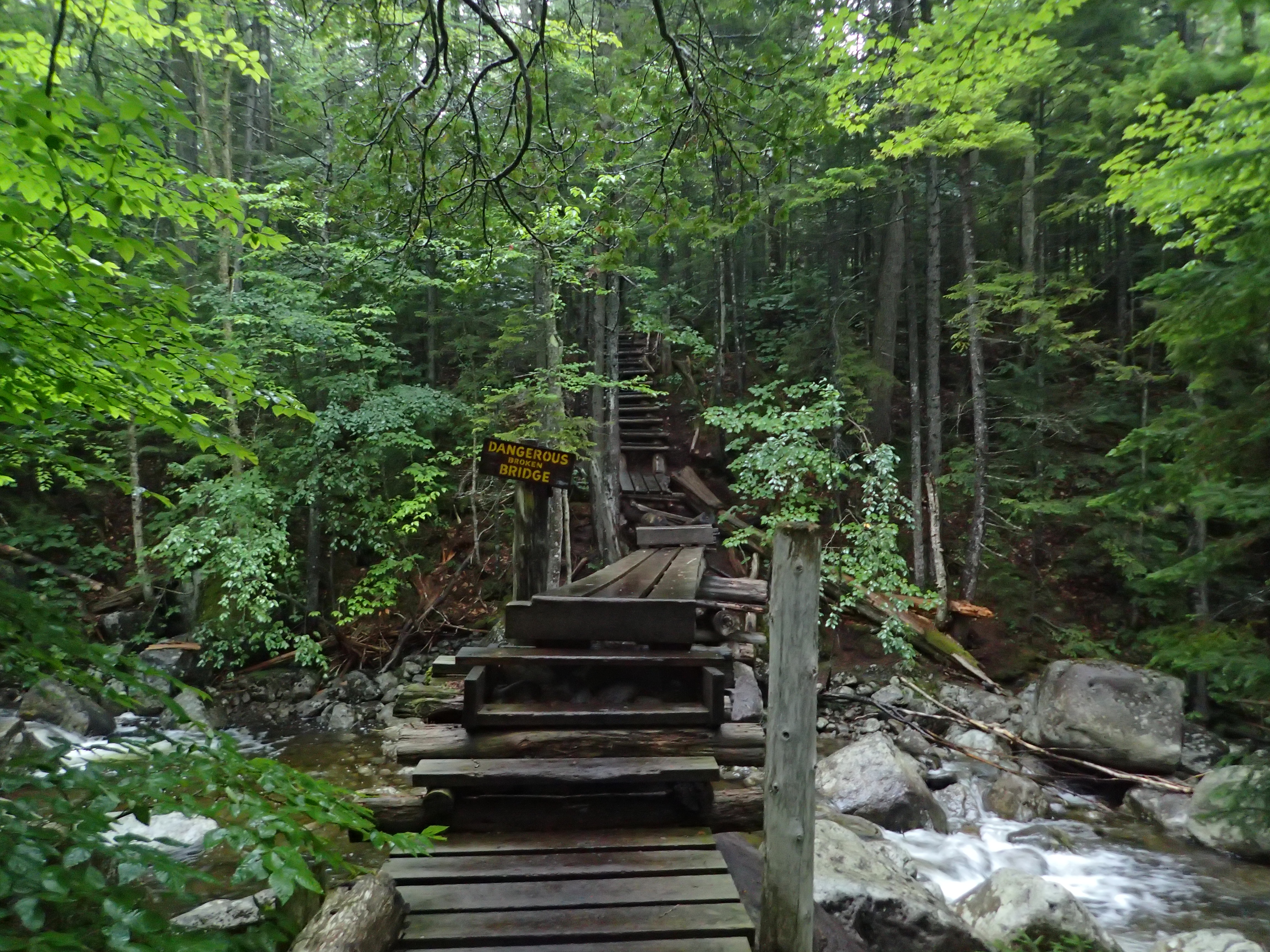
Dangerous Broken Bridge
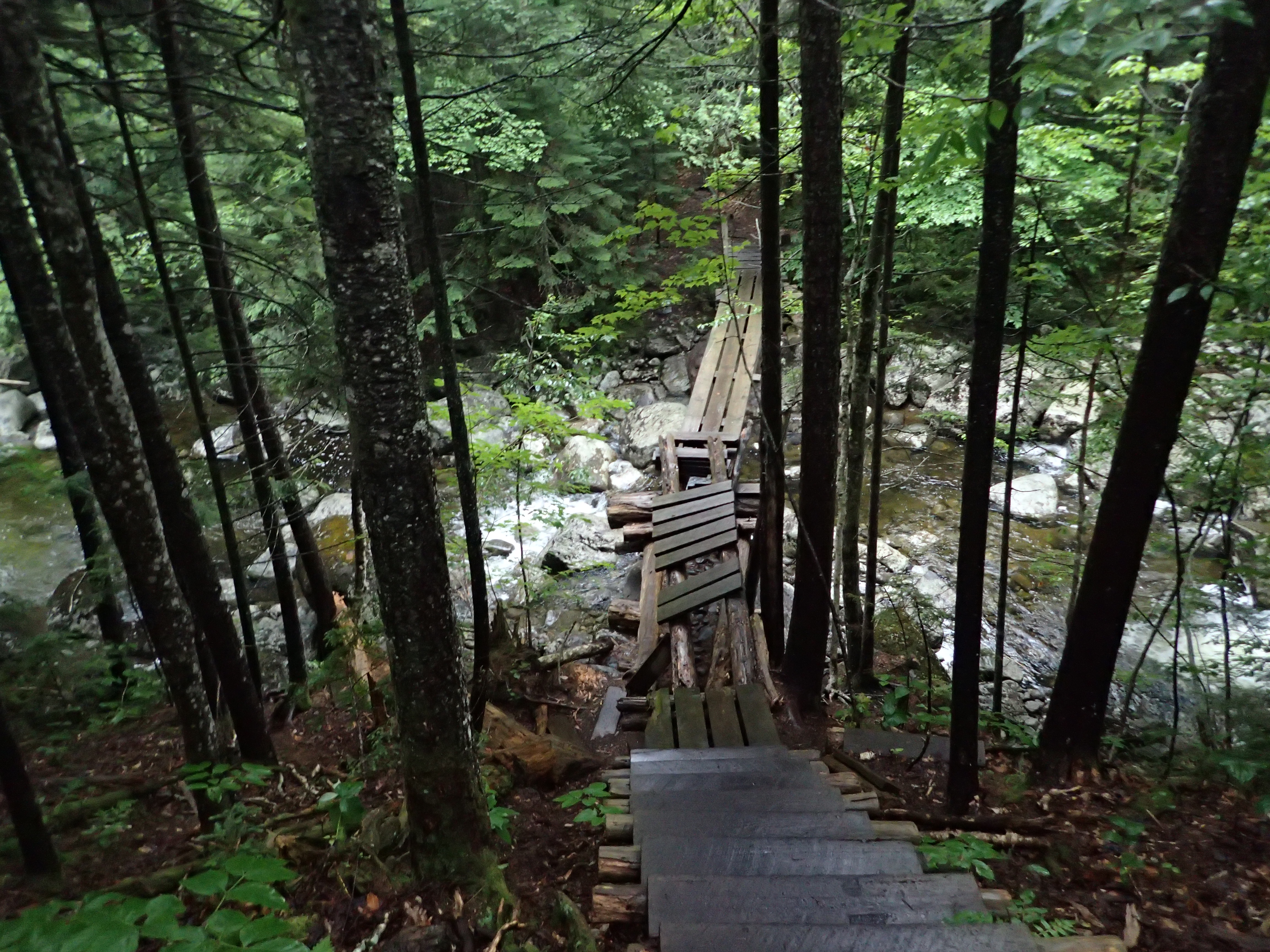
Looking down on the broken section
Once getting up the stairs on the other side of the bridge the trail began to get a bit more interesting. It was a classic rocky Adirondack trail that weaved in and out of the woods until meeting up and running parallel with the brook I had crossed earlier. Following the brook was one of the high lights of the day and if it had not been so rainy and crummy out I probably would of appreciated it more. However, despite the poor weather I did stop to take in the sights and snap some photos. I think these cold pools of water would have been very inviting as well if it was a nice hot sunny day.
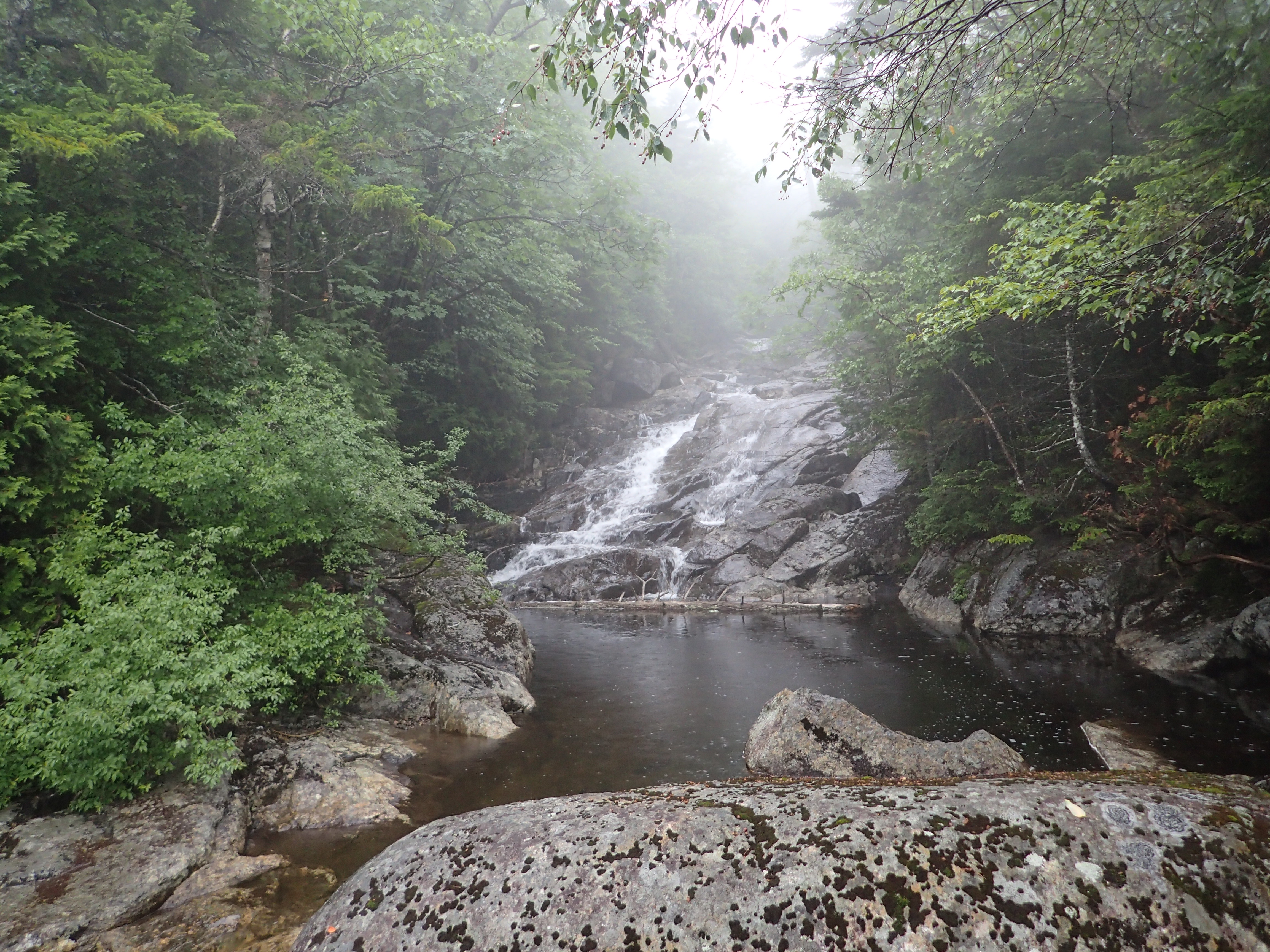
If only it were a nice hot day to jump in.
After about 2.6 miles on the marked trail I passed the first fork in the trail. Which coincidentally had a fork sticking out of the cairn. Making a left here will put you on the Santanoni express herd path leading up to Santanoni directly. I made a mental note of the trail but knew I would keep walking to the next herd path so that I could do the full loop and end with Santanoni instead of the other way around.

First fork in the trail.
After continuing on I stayed on the look out for the next cairn marking the herd path I needed. I figured if I walked too far I would hit the lean-to and just double back to figure out where the path was but I didn’t have to worry because the turn off was very clear. A convenient sign and cairn marked the way left and I was quickly on my way to Panther peak.

Herd path leading to Times Square and Panther
Immediately after walking down hill after turning down the herd path I was greeted by a nice pond. The trail goes left around the pond and back into the woods on the other side. This part of the trail was easy to follow and not as muddy as you would think.

The nice pond.
The rain at this point had been sporadic on and off but it had managed to soak me pretty well by this point. I got even more wet due to the foliage that hung over onto the trail on either side dumping water on me as I passed. Lucky for me it wasn’t a cold day so besides being damp and uncomfortable I was otherwise no worse for wear. This section was interesting and climbed gradually upwards until eventually reaching a flat spot on top of the ridge which had markers leading off to the right up to Panther. The split in the trail was easy to find as pretty much everything had a mark on it including trees and rocks pointing the way.

P marks the way!
The path to the summit of Panther went quickly and would of been very nice on top as it is fairly treeless with a nice big slab of rock to enjoy on a nice day. However, on this day it was completely cloaked in clouds and a rainy drizzle so I could not see a thing. You would think this was the summit but unfortunately you have to walk another maybe 20 feet across a big muddy sink hole that seems like it has gotten larger and larger as people have tried to avoid it. Unfortunately there is not another option across unless you want to contend with the man eating spruce. Once on the other side of the mud hole there is a neat little pocket in the trees which has a marker at your feet and a sign on the tree. I reached Panther Peak at 10:21am.

Panther Peak summit sign
I got back down off the summit fairly quickly and back to where I had turned. I continue down the other direction towards what is known as “Time Square”. Now I have to admit growing up 20 minutes from NYC when I think of Times Square, I think of a very big obvious intersection. So the entire time I was walking I was searching for a big obvious intersection with maybe a cairn or other markers indicating which way was what. I walked for a bit and still had not seen anything obvious and began to get a bit confused. After a while I passed a larger boulder with a trail leading straight and a very nondescript path leading to the left. I dismissed this path as a view point and just kept walking straight.
After walking for about an hour I still hadn’t found anything and really considered that I may have missed it and ended up heading for Santanoni instead of turning down the trail for Couchsachraga. Until suddenly I turned a corner and there it was, the summit sign. Apparently I had been heading towards Couch this whole time and had no idea. The lack of incline and sheer amount of mud and boring trail had made it seem impossible. Also after passing the biggest mud pit I have ever seen on any trail in the High Peaks, I can understand why most people list this as their least favorite high peak. Also I would suggest you don’t try to walk through any part of that mud as my poles dropped close to a foot or more before hitting solid anything.
Luckily Couch was wearing his party hat which made the whole experience much more festive. I made it to the summit at 11:55am.
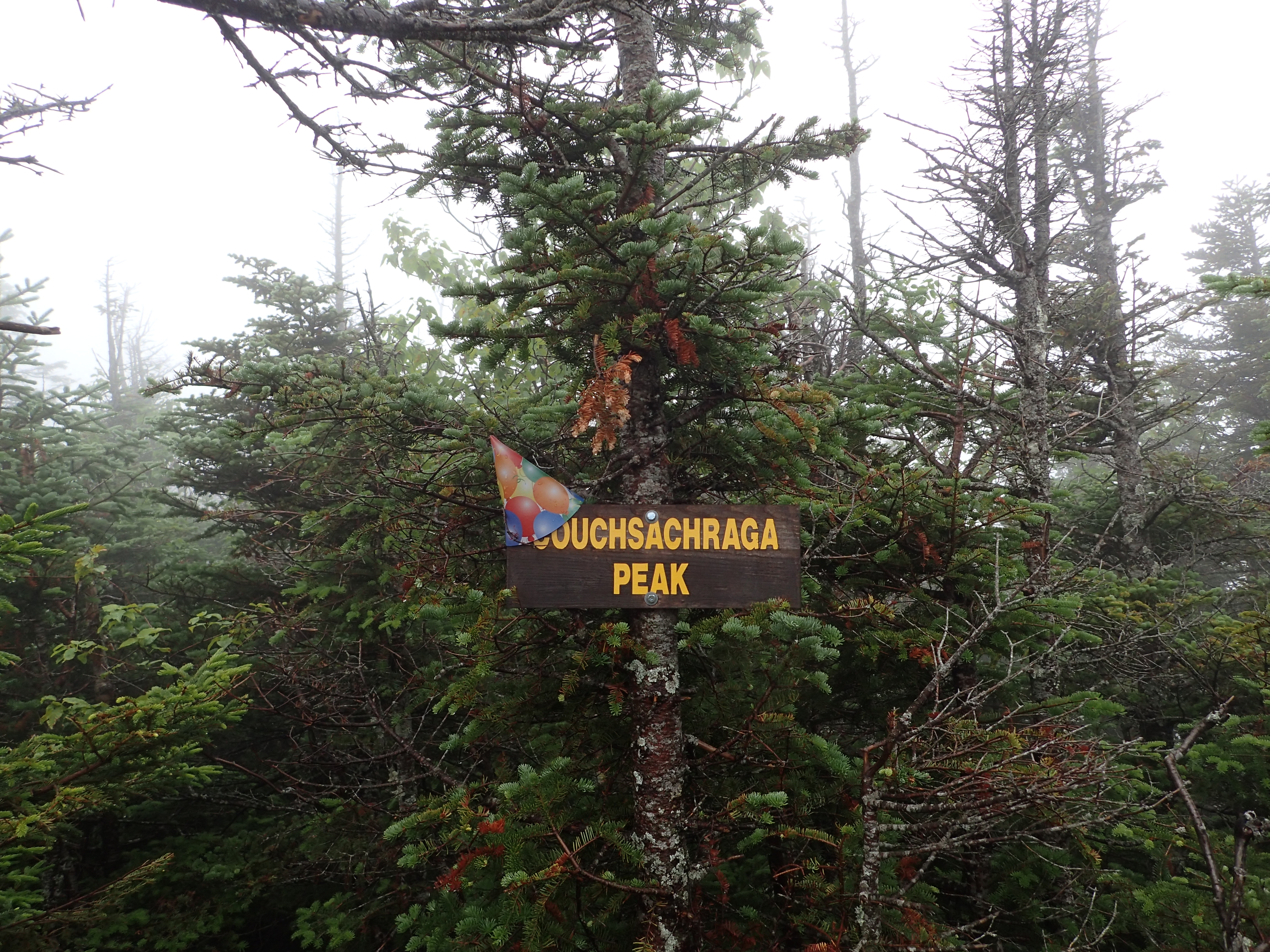
Couchsachraga in party mode
After finally hiking my way off Couch I realized that what I originally thought was a trail for an overlook was in fact the trail heading towards Santanoni and that junction was what people referred to as Times Square. Either way I was happy I had ended up on the right path even if it was by accident. The rest of the path to Santanoni followed the ridge line from Times Square and was fairly gradual and easy. The only issue was still all the rain and mud. I also was wearing boots that I normally don’t hike in which had my feet hurting in addition to becoming wet and squishy.
I made it to the summit of Santanoni by 2:13pm. It is a simple wooded summit with a sign marking the summit just past the intersection with the Santanoni express herd path on your left. The peak was still shrouded in the clouds so I was not able to see anything from the one rather large overlook I saw near the summit. However, luckily at this point the sun was beginning to peak through the clouds in spots and it had begun to warm up quite a bit.
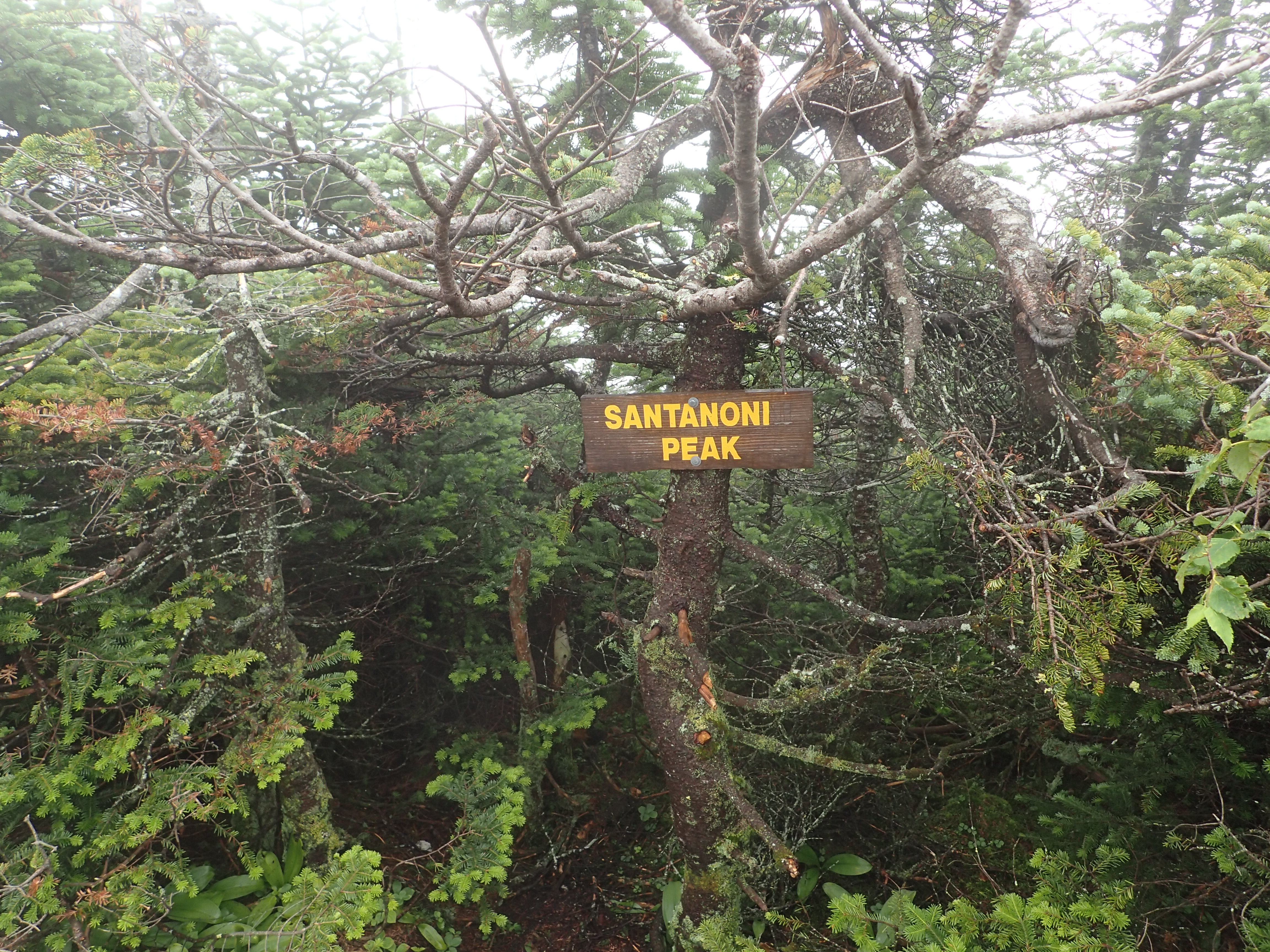
Santanoni summit sign
After leaving the final summit of the day I back tracked a short distance to the Santanoni express herd path. The trail turn off is on your right but I found it pretty easy to miss if you weren’t paying attention, but luckily this time I was. The decent from the top of the ridge also offered the only partial view I had seen all day.

The best view of the day.
The descent down the Santanoni express herd path was fairly straight forward and uneventful except for one part. After a little while descending the trail splits in what seem like two equally probable directions. To the left is a pretty standard Adirondack slab descent and to the right seems like a more mellow trail at first until you get down it a little ways. The right hand side actually leads to a rather steep rock slab which to my understanding used to have a rope on it but I didnt see it and there was no other easy way I could find down it considering it was soaking wet. I decided to turn around and try out the other path which turned out to be a much easier and safer way down. I would just recommend using caution in this section as a fall there would be really bad considering the height of the slab and how remote this particular range is.
After a couple of hours descending which took much longer than I would of liked due to weather, mud, and my uncomfortable and unfamiliar boots, I had reached the marked trail again. Once on the marked trail I was able to pick up my pace down the mountain and reached the road in pretty quick order. The road was a nice respite from the mud and by this point the sun was shinning on me which was nice considering how soaked I was but I wasn’t getting off that easily because that was when the bugs decided to keep me company the rest of the way back to the car. The conditions weren’t what I would of liked but it was still a great day in the mountains.
Categories: Adirondack High Peaks Region, Trip Reports


Reblogged this on conquering the climb; 46 Mountains, One Lifetime.
LikeLike
Nice Trip Report! Thank you. When I did this my first round, we did not do the Santanoni Express, but camped at the lean-to.
LikeLike
Thank you Carol! If the weather is nice I can see it being a good alternative to do it with a night at the lean-to.
LikeLike